Accessibility

Font Size

100% 150% 200%

Background Colour

Default Contrast
Close Reset

Birsay, Brough Road

Cairn (Period Unassigned), Cist (Period Unassigned), Inhumation (Period Unassigned), Midden (Period Unassigned)

Site Name Birsay, Brough Road

Classification Cairn (Period Unassigned), Cist (Period Unassigned), Inhumation (Period Unassigned), Midden (Period Unassigned)

Canmore ID 73553

Site Number HY22NW 62

NGR HY 2467 2805

Datum OSGB36 - NGR

C14 Radiocarbon Dating

Permalink http://canmore.org.uk/site/73553

Ordnance Survey licence number AC0000807262. All rights reserved.
Canmore Disclaimer. © Bluesky International Limited 2025. Public Sector Viewing Terms

Toggle Aerial | View on large map

Digital Images

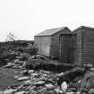
Area 1: After the Hurricane - Site Huts.
Area 1: After the Hurricane - Site Huts.Area 1: Cairn 2 - West edge of Cairn 17, southern part. Vertical photograph.Area 1: Cairn 2, preliminary side-view looking North.Area 1: Cairn 2, side view, looking South-West.Area 1: Cairn 2, top level of cairn.Area 1. Small find 202, antler.Area 1. Small find 200, flint.Area 1. Small find 200, flint.Area 1. Small find 204, iron.Area 1. Small find 320, worked stone.Area 1: Cairn 2, vertical photograph, Box B.Area 1: West edge of Cairn 17, far southern part._Vertical photograph. (Cairn 2)Area 1: Cairn 17, looking North. Vertical photograph. (Cairn 2)Area 1: Cairn 2, side view, North-East edge.Area 1: Cairn 2, lower grave exposed, looking South.Area 1: Cairn 2. High level shot, looking south-west.Area 1: preliminary excavation, looking south.Area 1: Cairn 2, vertical photograph, Box C.Area 1: Cairn 10 and West edge of Cairn 17. Vertcal photograph. (Cairn 2)Area 1: Cairn 2 - Cairn 17 and central fill of stone.Area 1: Cairn 2, context 17, and stone scatters.Area 1: Cairn 2, looking South-East.Area 1: Cairn 2, looking West.Area 1: Cairn 2, looking South-East.Area 1: Context 59.Area 1: Cairn 2, looking  South-East.Area 1. Small find 203, worked stone.Area 1. Small find 203, worked stone.Area 1. Small find 86, pumice.Area 1. Small find 13, cowrie shell.Area 1. Small find 320, worked stone.Areas 1 & 2: After the Hurricane - Damage to Areas 1 and 2.Area 1. East end, looking north. Layers 3 and 4.Area 1: Cairn 2, lower grave exposed.Area 1. Skull bone with notch, upper surface. Illus.189a.Area 1. Small find 208, iron.Area 1. Small find 207, cowrie shell.Area 1: Small Find 44, Iron.Areas 1 & 2: After the Hurricane - Damage to Areas 1 and 2.Area 1: Cairn 2 and trench, looking West.Area 1: Cairn 2, grave below cairn, looking North.Area 1: Cairn 2 and 18, looking East.Area 1. Small find 14, industrial waste.Area 1. Small find 13, cowrie shell.Area 1. Small find 205, antler.Area 1. Small find 205, antler.Areas 1 & 2: After the Hurricane - Damage to Area 1.Area 1: East end, looking west.Area 1: Cairn 2, looking East.Area 1: Cairn 2, looking East, cleaned further. (Double exposure)Area 1. Small find 201, bone.Area 1. Small find 88, flint.Area 1. Small find 204, iron.Area 1: Cairn 2, vertical photograph, Box A.Area 1: Cairn 2, looking  South-East.Area 1: Cairn 10 and West end of Cairn 17. Vertical photograph. (Cairn 2)Area 1: Cairn 2, side view, East edge.Area 1: Cairn 2, side view, West edge.Area 1: Cairn, side view, north edge.Area 1: Cairn 2, upper level, contexts, 16, 17, 18.Area 1. Cairn, upper level. Contexts 16, 17, 18, looking north.Area 1: Cairn and context 42, looking west.Area 1. Skull bone with notch, lower surface. Illus.189b.Area 1. Small find 201, bone.Area 1. Small find 202, antler.Area 1. Small find 208, iron.Area 1: Small Finds 16, iron, 23, industrial waste.Area 1. Small find 88, flint.Area 1. Small find 13, cowrie shell.

Administrative Areas

  • Council Orkney Islands
  • Parish Birsay And Harray
  • Former Region Orkney Islands Area
  • Former District Orkney
  • Former County Orkney

Archaeology Notes

HY22NW 62 2467 2805

See also HY22NW 61

To the E of HY22NW 61 was a cairn, excavated in 1978 and partly eroded by storms. The cairn overlay an extended skeleton aligned roughly NW-SE, with the head to the SE. Bone from this skeleton produced a radiocarbon date of 1705+/-80bp (GU-1554). The cairn was sealed by midden deposits in which was a disturbed Norse long cist grave aligned E-W (Area 1). Bone from this cist gave a radiocarbon date of 1240+/-85bp (GU-1553), while mammal bones from the lower midden area gave dates of 1250+/-55bp (GU-1956) and 1105+/-55bp (GU1957); and from sand over the midden, 1215+/-80bp (GU-1979). Small finds are in Tankerness House Museum, Kirkwall; biological material in RMS, Edinburgh.

C D Morris 1979h.

Activities

Excavation (1978)

To the E of HY22NW 61 was a cairn, excavated in 1978 and partly eroded by storms. The cairn overlay an extended skeleton aligned roughly NW-SE, with the head to the SE. Bone from this skeleton produced a radiocarbon date of 1705+/-80bp (GU-1554). The cairn was sealed by midden deposits in which was a disturbed Norse long cist grave aligned E-W (Area 1). Bone from this cist gave a radiocarbon date of 1240+/-85bp (GU-1553), while mammal bones from the lower midden area gave dates of 1250+/-55bp (GU-1956) and 1105+/-55bp (GU1957); and from sand over the midden, 1215+/-80bp (GU-1979). Small finds are in Tankerness House Museum, Kirkwall; biological material in RMS, Edinburgh.

C D Morris 1979h.

References

MyCanmore Image Contributions


Contribute an Image

MyCanmore Text Contributions