
Kinnaird Castle, Avenues


Avenue(S) (Period Unassigned)
Site Name Kinnaird Castle, Avenues
Classification Avenue(S) (Period Unassigned)
Canmore ID 73447
Site Number NO65NW 21.08
NGR NO 6307 5687
NGR Description From NO 628 567 to NO 633 570
Datum OSGB36 - NGR
Permalink http://canmore.org.uk/site/73447


- Council Angus
- Parish Farnell
- Former Region Tayside
- Former District Angus
- Former County Angus
NO65NW 21.08 6307 5687
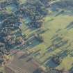
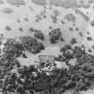
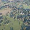
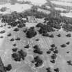
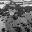
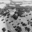
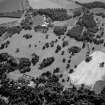
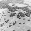
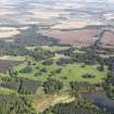
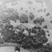
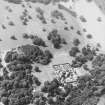
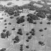
Traces of the pattern of the avenues can still be seen in the park to the west of the house after dry weather.
Land Use Consultants 1987.
Visible on RCAHMSAP 1990

