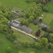
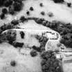
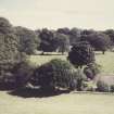
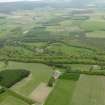
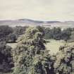
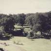
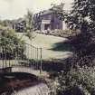
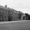
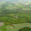
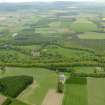
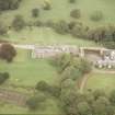
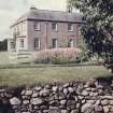
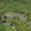
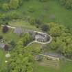
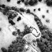
Accessibility

Font Size

100% 150% 200%

Background Colour

Default Contrast
Close Reset

The Burn

War Memorial (20th Century)

Site Name The Burn

Classification War Memorial (20th Century)

Alternative Name(s) The Burn War Memorial

Canmore ID 72323

Site Number NO57SE 77

NGR NO 59790 71651

Datum OSGB36 - NGR

Permalink http://canmore.org.uk/site/72323

Ordnance Survey licence number AC0000807262. All rights reserved.
Canmore Disclaimer. © Bluesky International Limited 2025. Public Sector Viewing Terms

Toggle Aerial | View on large map

Digital Images

Oblique aerial view centred on the country house, taken from the SW.
Oblique aerial view centred on the country house, taken from the SW.View of gardens from North-West across the path.View of bridge over canal.Oblique aerial view.View of gardens from West across the path.General view of Garden House in walled garden.View of the Layes Suspension Bridge.Oblique aerial view centred on the country house, taken from the SE.General oblique aerial view centred on the country house with the policies adjacent, taken from the SW.View over parkland, moorland beyond.View towards West from roof.View of cascade to South-West of house.View of horse paddocks.Oblique aerial view centred on the country house, taken from the SSE.General view of The Burn.General oblique aerial view centred on the country house with the policies adjacent, taken from the NW.General oblique aerial view centred on the country house with the policies adjacent, taken from the W.View of canal to walled garden.View of canal culvert into walled garden.Oblique aerial view centred on the country house, taken from the SSW.General oblique aerial view centred on the country house with the policies adjacent, taken from the WSW.View of the Layes Suspension Bridge.Oblique aerial view.Oblique aerial view.Aerial view of The Burn Country House, near Edzell, Angus, looking NW.View of The Burn.Oblique aerial view centred on the country house, taken from the E.Oblique aerial view centred on the country house, taken from the NE.Oblique aerial view.View of River Esk.

Administrative Areas

  • Council Aberdeenshire
  • Parish Fettercairn
  • Former Region Grampian
  • Former District Kincardine And Deeside
  • Former County Kincardineshire

Archaeology Notes

NO57SE 77.00 59790 71651

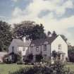
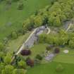
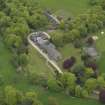
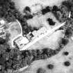
NO57SE 77.01 NO 59784 71707 Stable (The Courtyard House [Stable Block]

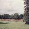
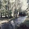
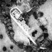
NO57SE 77.02 NO 59769 71642 Garden; Sundial( Formal Garden with Sundial)

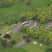
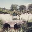
NO57SE 77.03 NO 59795 71743 Tunnel (Cattle Tunnel)

NO57SE 77.04 NO 59753 72144 Garden; Cottage (Garden Cottage)

NO67SW 38.00 NO 60099 70969 Gate-lodges

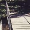
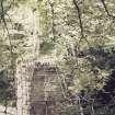
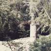
NO57SE 87 NO 59462 71716 Suspension Bridge (Loups Bridge)

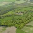
NO67SW 53.00 NO 6090 7228 Farmstead (Burn Farm )

NO67SW 53.01 NO 6062 7229 Cottage (Burn Cottages)

References

MyCanmore Image Contributions


Contribute an Image

MyCanmore Text Contributions