Stirling - Tyndrum - Fort William Military Road
Military Road (18th Century)
Site Name Stirling - Tyndrum - Fort William Military Road
Classification Military Road (18th Century)
Canmore ID 72297
Site Number NN51SE 6
NGR NN 5870 1200
NGR Description NN 5882 1000 to NN 5650 1499
Datum OSGB36 - NGR
Permalink http://canmore.org.uk/site/72297
- Council Stirling
- Parish Callander
- Former Region Central
- Former District Stirling
- Former County Perthshire
NN51SE 6.00 5882 1000 to 5650 1499
NN 5885 1000 - NN 5650 1499 course of military road shown by Roy (1747-55).
NN 5882 1000 - NN 5880 1008 road visible as occupation road.
NN 5880 1008 - NN 5866 1058 road visible as a cart track averaging 6m wide.
NN 5866 1058 single-span Wade type bridge (NN51SE 7).
NN 5866 1058 - NN 5862 1070 road clearly visible between old walls averaging 6m to 7m in width but measuring 9m wide at one point.
NN 5862 1070 - NN 5650 1499 modern road on line of military road.
Visited by OS (WDJ) January 1969.
W Roy (1747-55).
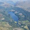
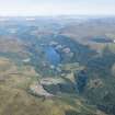
Initially the military road heads over a wooded hillock, passes Anie, and descends to the line now followed by the A84, linking with it at a point opposite the car park at the S end of Loch Lubnaig. Just S of the junction the military road traverses a ruined bridge (NN51SE 7). The line is then overlain by the modern road as it heads N up the lochside. Across the loch from Laggan Farm there is a regimental stone (NN51SE 6.01) at NN c. 566 147, bearing the date 1769 and letters which would appear to indicate that it was associated with the 4th Regiment (the King's Own Royal Regiment), who by that date must have been undertaking repairs and maintenance.
W Taylor 1976.
There is a discrepancy in the S part of the military road shown on this map sheet, as far N as NN 5862 1070, between the route shown by Roy (1747-55), which coincides with the line now followed by the A84, and that recorded by the OS (WDJ) in January 1969 and Taylor (1976), which takes the form of a track going over the hill to the E of the modern road.
Information from RCAHMS (MW), 22 December 1999.


