
Pricing Change
New pricing for orders of material from this site will come into place shortly. Charges for supply of digital images, digitisation on demand, prints and licensing will be altered.
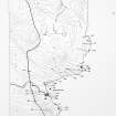
Sgarbach, Auchingill


Promontory Fort (Period Unassigned)
Site Name Sgarbach, Auchingill
Classification Promontory Fort (Period Unassigned)
Alternative Name(s) Can 086
Canmore ID 72044
Site Number ND36SE 5
NGR ND 3729 6375
Datum OSGB36 - NGR
Permalink http://canmore.org.uk/site/72044


- Council Highland
- Parish Canisbay
- Former Region Highland
- Former District Caithness
- Former County Caithness
ND36SE 5 3729 6375
(ND 3729 6375) Dun (NR)
OS 1:10,000 map, (1973)
This is apparently a promontory dun, more closely allied to those of the Western Isles than to any local site.
R W Feachem 1963.
It consists of a cliff-girt headland cut off by a well-constructed drystone wall, some 62ft long, 12 1/2ft thick, and about 4ft high. Somewhat to the east of the centre, the wall is pierced by a passage with door-checks, door-sill and bar-hole. 'At the inner end of the passage, and to the left, some 4ft back from it, is an oval chamber, measuring about 10ft by 7ft'.
A hearth defined by flags set on end, and containing ashes, food refuse and fragments of pottery, was located in the rear of the entrance.
A drain passed from the interior outwards below the floor of the entrance passage.
The site was excavated by Sir Francis Tress Barry.
RCAHMS 1911, visited 1910.
This is a ruined dun. It is generally as described above except that this east bar hole and door-check have been destroyed and the hearth was not evident at investigation.
Surveyed at 1:2500.
Visited by OS (RD) 14th September, 1965.
A blockhouse-type structure on an L-shaped promontory whose seaward section lies parallel with the mainland, which is slightly higher (of Dun Whairtein: NC86NE 1).
Unlike others of its type on the mainland, Sgarbach appears to have been a complete barrier across the promontory; and while it is not known if it contained a ground gallery, it is massive enough to have done so.
The defence now appears as a broad mound across the isthmus and various mounds on either side of the rampart are probably excavation spoil.
It is probably to be dated not much before the 1st century BC, if not within it.
R G Lamb 1980.
'Promontory fort of a type related to Midhowe forework and ultimately to Shetland blockhouses'.
Information from Dr R Lamb, 1980.
Very badly damaged by stone removal and collapse.
C E Batey 1982.
A dun, as described by previous authorities.
Visited by OS (NKB), 22 July, 1982.
Project (1980 - 1982)
Field Visit (1982)
Very badly damaged by stone removal and collapse.
C E Batey 1982.
Publication Account (2007)
ND36 11 SGARBACH
ND/3729 6375
This promontory fort in Canisbay, Caithness was partly excavated by Sir Francis Tress Barry during the 1890s and is included here because of the similarity of the door-frame to that found in brochs. No plan made at the time of the excavations is known but some photographs were taken; the only nearly contemporary description is that of the Royal Commission [2].
The site consists of a simple curved wall crossing the landward end of a high, cliff promontory of which the length from cliff to cliff was 18.9m (62ft); it was 3.8m (12ft 6in) thick and about 1.2m (4ft) high near the middle. Slightly east of the mid point the entrance passage was found, 96.5cm (3ft 2in) wide at the outer end. Although its left wall was broken down, the right wall was reasonably well preserved and a door-check, formed of an upright slab against a built face, was found in it 2.03m (6ft 8in) from the exterior; behind this the passage widened to 1.45m (4ft 9in). The floor of the passage was paved with large sandstone slabs and another thin slab, projecting 20cm (8in) above the floor, formed a sill stone. This is described [2] as being in front of the door-check but the photograph suggests that it is in line with it. Behind the door-frame a bar hole is in the right wall; this was 20cm (8in) square and was found to be at least 1.07m (3ft 6in) deep. A drain was found under the flags of the passage floor, leading from the interior to the outside.
Behind the wall and approximately in line with the entrance was a hearth formed of flags set on edge and full of ashes, food refuse and pottery. To the left of the inner edge of the passage and about 1.22m (4ft) back from it was found an oval chamber in the wall, measuring about 3.05 by 2.14m (10 x 7ft).
Discussion
It is pity that so little is known about this site, and in particular that nothing is known about the pottery found. There are good reasons for thinking that some promontory defences belong to the early Iron Age, probably at least as early as the 6th century BC; examples are the promontory semibrochs (sites NG31 1 and HU44 1) as well as the Shetland 'gatehouse forts (sites HU30 3 and HU56 4). Sgarbach may be another of these early defensive sites and it would be worth re-excavating it with the aim of establishing its date.
Sources: NMRS site no. ND 36 SE 5: 2. RCAHMS 1911b, 18, no. 45: 3. Feachem 1977, 180: 4. Lamb 1980b, 26 and fig. 8: 5. Batey 1984, 65, site CAN 086: 6. Swanson (ms) 1985, 569-70.
E W MacKie 2007
Note (19 February 2015 - 31 May 2016)
This fort is situated on a precipitous promontory below Nybster, about 600m further north from the Nybster broch. The promontory describes a V on plan, the W arm of which forms the neck on the landward side, and the E arm projects ENE out into the sea. The defences comprises a single thick wall, now reduced to a broad but heavily disturbed bank, which bars access along the W arm from the NNE, cutting off an area of about 0.15ha, measuring 50m from NNE to SSW and 70m from ENE to WSW along the respective arms. The disturbance visible today is largely the result of collapse of masonry exposed by the excavations by Sir Francis Tress Barry about 1897 and has taken place since it was visited by Alexander Curle during the preparation of the County Inventory for Caithness (RCAHMS 1911, 18, no.45). Curle records that the wall was 3.8m in thickness and still stood 1.2m high, and contemporary photographs show the neatly coursed faces at the entrance, which lies a little E of the centre and was furnished with a raised sill at a door-check in the passage, and a bar-hole in the wall; he also describes an oval chamber measuring about 3m by 2.1m on the E of the passage, but whether this was constructed within the thickness of the wall or to its rear is not entirely clear from his description. More definitely a drain ran out beneath the paved floor of the entrance passage, and a slab-built hearth was discovered with pottery to the rear of the entrance.
Information from An Atlas of Hillforts of Great Britain and Ireland – 31 May 2016. Atlas of Hillforts SC2832

