
Pricing Change
New pricing for orders of material from this site will come into place shortly. Charges for supply of digital images, digitisation on demand, prints and licensing will be altered.
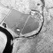
Cnoc A' Chrochaidh


Natural Feature (Period Unknown)
Site Name Cnoc A' Chrochaidh
Classification Natural Feature (Period Unknown)
Canmore ID 7174
Site Number NC92SW 17
NGR NC 9107 2099
Datum OSGB36 - NGR
Permalink http://canmore.org.uk/site/7174


- Council Highland
- Parish Kildonan
- Former Region Highland
- Former District Sutherland
- Former County Sutherland
NC92SW 17 9107 2099.
(NC 9107 2099) Cnoc a Chreachaidh (NAT)
OS 6"map, Sutherlandshire, 1st ed., (1878)
Cnoc a Chrochaidh (NAT)
OS 6"map, (1963)
Knock'nreachy, (New Statistical Account [NSA] 1841) Cnoc a Chreachaidh (Name Book 1871) or Torr-an-riachaidh, the scratching knowe, from the whin bushes growing on it, is 'a most remarkable cairn.... Its shape is a perfect cone, about 60' high and about 90' circumference at the base. A few years ago the top was laid open when it was found to consist of a huge pile of stones. Traditionally this cairn is said to mark the burial place of a Norwegian leader defeated in battle here against the natives.' (D Sage 1898) All the authorities agree that the mound is artificial.
Cnoc a Chrochaidh is apparently natural. It is said that a passage, now filled in, led into the heart of it.
RCAHMS 1911, visited 1909
A conical morraine
Visited by OS (N K B) 27 Feburary 1968
No change to field report.
Visited by OS (J M) 8 Feburary 1977.

