
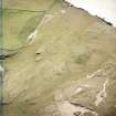
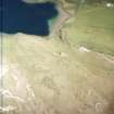
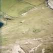
Loch Borralie


Farmstead (Period Unassigned)
Site Name Loch Borralie
Classification Farmstead (Period Unassigned)
Canmore ID 71543
Site Number NC36NE 75
NGR NC 3786 6675
Datum OSGB36 - NGR
Permalink http://canmore.org.uk/site/71543


- Council Highland
- Parish Durness
- Former Region Highland
- Former District Sutherland
- Former County Sutherland
NC36NE 75 3786 6675.
A steading, consisting of a longhouse 13m by 5m, a hut 6m by 4m, a kiln and an enclosure lies below the 100ft contour about 50m W of the jetty.
T C Welsh 1972i.
Early modern steading as described; the 'hut' is an associated rectangular outhouse. The structures survive to 0.4m high.
Visited by OS (JB) 29 April 1980.

