Accessibility

Font Size

100% 150% 200%

Background Colour

Default Contrast
Close Reset

Pricing Change

New pricing for orders of material from this site will come into place shortly. Charges for supply of digital images, digitisation on demand, prints and licensing will be altered. 


Kilphedir Bridge

Road Bridge (19th Century)

Site Name Kilphedir Bridge

Classification Road Bridge (19th Century)

Alternative Name(s) Strath Of Kildonan; Allt Cille Pheadair

Canmore ID 7052

Site Number NC91NE 74

NGR NC 98964 18636

Datum OSGB36 - NGR

Permalink http://canmore.org.uk/site/7052

Ordnance Survey licence number AC0000807262. All rights reserved.
Canmore Disclaimer. © Bluesky International Limited 2025. Public Sector Viewing Terms

Toggle Aerial | View on large map

Digital Images

Administrative Areas

  • Council Highland
  • Parish Kildonan
  • Former Region Highland
  • Former District Sutherland
  • Former County Sutherland

Archaeology Notes

NC91NE 74 98964 18636

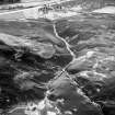
This bridge carries the A897 public road over the Allt Cille Pheadair a short distancxe above its debouchement into the River Helmsdale.

Information from RCAHMS (RJCM), 7 May 2001.

References

MyCanmore Image Contributions


Contribute an Image

MyCanmore Text Contributions