Accessibility

Font Size

100% 150% 200%

Background Colour

Default Contrast
Close Reset

Pricing Change

New pricing for orders of material from this site will come into place shortly. Charges for supply of digital images, digitisation on demand, prints and licensing will be altered. 
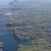
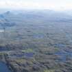
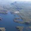
 

'Innerlaxford'

Township (Period Unassigned)

Site Name 'Innerlaxford'

Classification Township (Period Unassigned)

Canmore ID 70476

Site Number NC24NW 6

NGR NC 237 470

Datum OSGB36 - NGR

Permalink http://canmore.org.uk/site/70476

Ordnance Survey licence number AC0000807262. All rights reserved.
Canmore Disclaimer. © Bluesky International Limited 2025. Public Sector Viewing Terms

Toggle Aerial | View on large map

Digital Images

General oblique aerial view of Loch Laxford with Ben Stack beyond, taken from the WNW.
General oblique aerial view of Loch Laxford with Ben Stack beyond, taken from the WNW.General oblique aerial view of Loch Laxford with Ben Stack beyond, taken from the WNW.General oblique aerial view of Loch Laxford with Ben Stack beyond, taken from the WNW.

Administrative Areas

  • Council Highland
  • Parish Eddrachillis
  • Former Region Highland
  • Former District Sutherland
  • Former County Sutherland

Archaeology Notes

NC24NW 6 237 470.

NC 237 470. Innerlaxford, a group of buildings.

W Roy 1747-55, sheet 34/4.

References

MyCanmore Image Contributions


Contribute an Image

MyCanmore Text Contributions