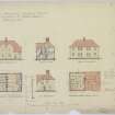
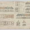
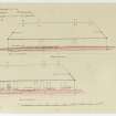
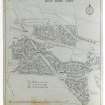
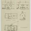
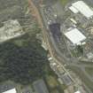
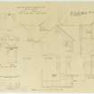
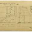
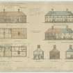
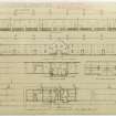
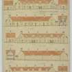
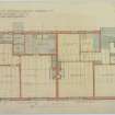
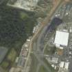
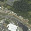
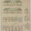
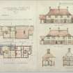
Accessibility

Font Size

100% 150% 200%

Background Colour

Default Contrast
Close Reset

Rosyth, General

Town (Period Unassigned)

Site Name Rosyth, General

Classification Town (Period Unassigned)

Canmore ID 70444

Site Number NT18SW 265

NGR NT 11795 83525

NGR Description Centred on NT 11795 83525

Datum OSGB36 - NGR

Permalink http://canmore.org.uk/site/70444

Ordnance Survey licence number AC0000807262. All rights reserved.
Canmore Disclaimer. © Bluesky International Limited 2025. Public Sector Viewing Terms

Toggle Aerial | View on large map

Digital Images

Plans, sections, and elevations.
Insc: 'Scottish National Housing Company Limited Rosyth Housing Fourth Development Type X'.
Plans, sections, and elevations.
Insc: 'Scottish National Housing Company Limited Rosyth Housing Fourth Development Type X'.Drawing showing plans, elevations and sections
Titled: 'Scottish National Housing Co Ltd. Housing Scheme Rosyth. Type EE'
Signed: 'A.H. Mottram'General oblique aerial view of North Queensferry with the Forth Bridges in the foreground, taken from the ESE.General oblique aerial view of Rosyth and Inverkeithing North Junction, taken from the E.Drawing showing elevations and ground works of building for Rosyth Housing Scheme. 	Site plan of housing scheme for Rosyth.Drawing showing plans, elevations and sections
Titled: 'Scottish National Housing Co Ltd. Housing Scheme Rosyth. Type EE'
Signed: 'A.H. Mottram'General oblique aerial view centred on the naval dockyard with the remains of the tower-house in the foreground, taken from the NE.General oblique aerial view of Rosyth and Inverkeithing North Junction, taken from the E.Aerial viewOblique aerial view.Drawing showing elevations and plans of semi-detached houses for Rosyth Housing Scheme.Oblique aerial view of the town centred on the remains of the tower-house with Rosyth Europarc adjacent, taken from the E.Oblique aerial view.Type 'L' Plans, elevations & sections
Coloured copy
Approved drawings
Signed: 'A.H. Mottram'Oblique aerial view of the town centred on the remains of the tower-house with Rosyth Europarc adjacent, taken from the NW.Drawing showing elevations, sections, plans and details of side wings and chimney breasts of building for Rosyth Housing Scheme.Drawing showing elevation and sections of window cill for Rosyth Housing Scheme. Drawing showing plans, elevations and sections
Titled: 'Scottish National Housing Co Ltd. Housing Scheme Rosyth Type P'
Signed: 'A.H. Mottram'General oblique aerial view of Rosyth, Forth Rail Bridge and Forth Road Bridge, taken from the NW.Aerial viewOblique aerial view.Oblique aerial view.Drawing showing elevations and plans of housing block for Rosyth Housing Scheme.Drawing showing plans, elevations and section of house type P for social housing, Rosyth.Section and elevations of Type K housing.Ground and first floor plans of Rosyth Housing Type Y.
General oblique aerial view centred on the naval dockyard with the remains of the tower-house in the foreground, taken from the NE.Oblique aerial view of the town centred on the remains of the tower-house with Rosyth Europarc adjacent, taken from the WNW.Oblique aerial view of the town centred on the remains of the tower-house with Rosyth Europarc adjacent, taken from the SSW.Aerial viewAerial viewAerial viewOblique aerial view.Plans, sections and elevations.
Insc: 'Scottish National Housing Company Limited Housing Scheme Rosyth Type O'.Drawing showing plans, elevations and sections
Titled: 'Scottish National Housing Co Ltd. Housing Scheme Rosyth. Type JJ'
unsignedOblique aerial view of the town centred on the remains of the tower-house with Rosyth Europarc adjacent, taken from the WSW.Aerial viewAerial viewOblique aerial view.Aerial viewOblique aerial view.

Administrative Areas

  • Council Fife
  • Parish Dunfermline
  • Former Region Fife
  • Former District Dunfermline
  • Former County Fife

References

MyCanmore Image Contributions


Contribute an Image

MyCanmore Text Contributions