
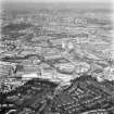
Glasgow, Cathcart, General


General View (Period Unassigned)
Site Name Glasgow, Cathcart, General
Classification General View (Period Unassigned)
Canmore ID 70171
Site Number NS56SE 349
NGR NS 58 60
Datum OSGB36 - NGR
Permalink http://canmore.org.uk/site/70171


- Council Glasgow, City Of
- Parish Cathcart (City Of Glasgow)
- Former Region Strathclyde
- Former District City Of Glasgow
- Former County Lanarkshire
CATHCART
The large estate of Cathcart belonged to the family of that name for several hundred years, before passing to the Semple 'in-laws' in the 16th century. The Earl of Cathcart bought back the estate and its Castle in 1801. The Old Kirkton was sited below the Castle, near the 17th-century Old Bridge on the main road from Glasgow to Ayr (bridge rebuilt in the late 18th century). Printfields and bleachfields were located at the Old Kirkton. Papermaking was started by Nicholas Deschamp at Millholm on the left bank of the river in 1729. Millholm briefly became a snuffmill between the 1760s and c.1830. The Couper family developed the paper business here in the mid-19th century. The Meal Mill on the right bank of the river became Cathcart Paper Mill in 1812. From 1814 snuff was made in small quantities in a part of the mill, which was closed in 1902. The New Bridge was built half a mile downstream about 1800 when a new road to Ayrshire - now Clarkston Road - was opened, and a new Cathcart Village developed. G & J Weir opened their foundry in 1886 and tenement building went ahead when the Cathcart Railway opened as a spur line in 1884. The Cathcart Circle was completed in 1894 and the trams arrived in 1902. Cathcart was annexed by Glasgow in 1912 and the City bought the rest of the estate in 1927 to form Linn Park.
Taken from "Greater Glasgow: An Illustrated Architectural Guide", by Sam Small, 2008. Published by the Rutland Press http://www.rias.org.uk

NMRS REFERENCE:
Photographs: Bedford Lemer Book 7, 24741 - negative series of 29.
Cathcart Castlemains:
Photocopy of plan by Thomas Kyle of piece of ground adjoining Castlemains. Part of contract of excavation, 1857 in book of Cathcart Documents. Filed in photo-box. Missing at time of upgrade, 29.6.2000
The location of Causewayhead, depicted in collection items D65089 and D 65090 CN, cannot be established at time of entry. The appearance of what seems to be Cathcart Castle in the view suggests that it was in this area, perhaps east of the River Cart in the vicinity of Holmhead or Braehead. Anne Cassells, 26 January 2005.

