
Pricing Change
New pricing for orders of material from this site will come into place shortly. Charges for supply of digital images, digitisation on demand, prints and licensing will be altered.
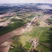
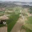
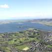
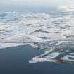
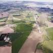
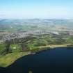
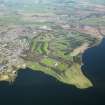
Kinross, General


Burgh (Medieval), Town (Period Unassigned)
Site Name Kinross, General
Classification Burgh (Medieval), Town (Period Unassigned)
Canmore ID 69971
Site Number NO10SW 35
NGR NO 1195 0210
Datum OSGB36 - NGR
Permalink http://canmore.org.uk/site/69971


- Council Perth And Kinross
- Parish Kinross
- Former Region Tayside
- Former District Perth And Kinross
- Former County Kinross-shire
NMRS REFERENCE
Kinross, West U. P Church.
Precise location uncertain at time of upgrade, 26/01/01
Photograph A 39398, copied 1987.
Insc: 'West U.P. Church, Kinross, 6281. G.W.
EXTERNAL REFERENCE - SCOTTISH RECORD OFFICE
Kinross, Seceders House
Obligation by William Petrie to infeft James henderson of Turfhills & David Morison baker in Kinross in "a great large house" built by them and the Seceding community of Kinross.
1748 GD76/413
Kinross, General.
RHP 9201 John Taylor 1788 - plan of miln lands of Kinross with vignettes of houses & church.
Photographic Survey (1955)
Photographs of buildings in Kinross by the Scottish National Buildings Record in 1955.

