
Eldrable


Broch (Iron Age)(Possible)
Site Name Eldrable
Classification Broch (Iron Age)(Possible)
Alternative Name(s) Eldrable Burn
Canmore ID 6993
Site Number NC91NE 20
NGR NC 9833 1816
Datum OSGB36 - NGR
Permalink http://canmore.org.uk/site/6993


- Council Highland
- Parish Kildonan
- Former Region Highland
- Former District Sutherland
- Former County Sutherland
NC91NE 20 9833 1816.
(NC 9833 1816) Broch (NR)
OS 6" map, 1964.
On the W bank of the Eldrable burn, some 200' up from the Helmsdale river, are the remains of a broch. The interior is a mass of debris, and in no place is the wall visible for a height greater than 3', except at the back of the entrance to the stair where about 5' of walling remains exposed. The entrance has been opposite the burn and has been 4' wide near the exterior. Along the inner face of the wall to the southwards is the entrance to the stair through a passage about 3' in length. There has been no chamber adjoining the stair, four steps of which are visible.
RCAHMS 1911, visited 1909.
The broch is in a very dilapidated condition. Abutting on the S side are traces of an enclosure but too obscure for survey.
Visited by OS (W D J) 17 May 1960.
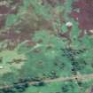
This broch is set on a knoll and is generally as described. The internal diameter is 7.5m and the wall width is a varying 3.5-4.5m; only the S side of the entrance, from the E, can be identified. The broch wall at the outside stands to a maximum of 1.6m high in the N. A later, ruinous wall, that runs in a general E-W direction, incorporates the broch wall. A stony scarp, partially overlaid by tumble from the broch, encloses the summit area of the knoll, and is probably the remains of an outer defensive wall.
There appears to be further defensive works at the base of the knoll, but these form no cohesive pattern, and occur only in the N and W where the natural defences are strongest. They comprise a ditch in the gulley in the W, which fades to a terraced effect as it continues in a NE direction. The pattern of these works is obscured by a later track, extending from a collapsed stone bridge, which crosses the steam to the NE of the broch.
Visited by OS (J M) 5 October 1976.
Publication Account (2007)
NC91 4 ELDRABLE NC/9833 1816
This probable broch in Kildonan, Sutherland, stands on the west bank of the Eldrable burn about 200m from the junction with the river Helmsdale, and about 60m (200ft) above it; it is most easily reached by way of a suspension footbridge at NC/987184 (visited in 1987). It stands on the upper end of a ridge with the burn gorge on one side and a hollow on the other.
The building is fairly well preserved but, being made of polygonal blocks of metamorphic rock, few structural features are apparent. The outer face can be traced nearly all the way round and stands several courses high in places, above the surrounding rubble. The entrance was on the east-north-east facing the stream and was about 1.22m (4ft) wide at the outer end [2]; however the passage has evidently since been destroyed or buried [4].
The doorway to the mural stair is visible 4.12m (13.5ft) to the left (clockwise) of the entrance (at about 9 o'clock) and 4 steps of the stair are visible rising to the right. The sides of the stair-foot guard cell can be traced for a short distance to the left of the door. The inner face is visible, several courses high in places and there is a suggestion of a gallery 0.9m wide in the north-west [4]. There are slight signs of some outer defence works but they are not easily made sense of [1, 4].
Dimensions: the inner face indicates an internal diameter of about 7.63m (25ft). The wall thickness is about 3.66m (12ft) – or 3.2 - 4.0m [4] – so the external diameter would thus be about 14.95m (49ft) and the wall proportion 49% of the total.
Sources: 1. NMRS site no. NC 91 NE 20: 2. RCAHMS 1911a, 106, no. 309: 3. Stuart 1867: 4. Swanson (ms) 1985, 783-84 and plan.
E W MacKie 2007

