Oulmsdale Burn
Field System (Period Unassigned), Hut Circle(S) (Prehistoric)
Site Name Oulmsdale Burn
Classification Field System (Period Unassigned), Hut Circle(S) (Prehistoric)
Canmore ID 6988
Site Number NC91NE 16
NGR NC 958 174
NGR Description Centred NC 958 174
Datum OSGB36 - NGR
Permalink http://canmore.org.uk/site/6988
- Council Highland
- Parish Kildonan
- Former Region Highland
- Former District Sutherland
- Former County Sutherland
NC91NE 16 centred 958 174.
(Centred NC 958 174) Enclosures (NR) (Four shown A-D).
OS 6" map, (1964)
Four hut circles were located during field investigation.
(Undated) information in NMRS.
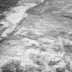
On a gentle N-facing moorland hillslope is a settlement of four hut circles (A-D) within a field system.
The huts are broadly similar, though obscured by peat and heather-growth, and C and D are denuded. The entrance to each hut is in the E arc. B, the best- preserved, measures 10.5m E-W by 8.5m N-S internally within a wall spread to about 3.0m broad, but widening to 3.5m at the entrance which appears club-shaped. A stone clearance heap occurs just outside the entrance in the manner of a windbreak. Hut a is 8.0m internal diameter within a wall spread to 3.0m, widening to 3.5m at the entrance, which may be clubbed. A lynchet extends from the SW arc. Huts C and D each measure internally 9.5m E-W by 8.0m N-S.
The field system is clearly defined in the vicinity of the huts by cultivation plots delineated by stone clearance heaps and lynchets. One plot adjacent to hut D measures 38.0m by 26.0m. The plots are not obvious on the fringes of the system, where the clearance is more widely scattered.
Revised at 1/10,000.
Visited by OS (N K B) 24 May 1976.


