
Pricing Change
New pricing for orders of material from this site will come into place shortly. Charges for supply of digital images, digitisation on demand, prints and licensing will be altered.
Skye, Suisnish


Building(S) (Period Unassigned)
Site Name Skye, Suisnish
Classification Building(S) (Period Unassigned)
Alternative Name(s) Lower Suisnish
Canmore ID 69847
Site Number NG51NE 12.09
NGR NG 5903 1628
Datum OSGB36 - NGR
Permalink http://canmore.org.uk/site/69847

- Council Highland
- Parish Strath
- Former Region Highland
- Former District Skye And Lochalsh
- Former County Inverness-shire
NG51NE 12.9 5903 1628.
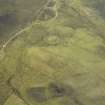
Lying amongst rough pasture on a W-facing hillside at 24m OD are the ruinous remains of three rectangular houses, all aligned NE-SW.
Visited by M Craik 3 April 1990.

