Pricing Change
New pricing for orders of material from this site will come into place shortly. Charges for supply of digital images, digitisation on demand, prints and licensing will be altered.
Kintradwell
Broch (Iron Age)
Site Name Kintradwell
Classification Broch (Iron Age)
Alternative Name(s) Cinn Trolla
Canmore ID 6964
Site Number NC90NW 5
NGR NC 9293 0807
Datum OSGB36 - NGR
Permalink http://canmore.org.uk/site/6964
- Council Highland
- Parish Loth
- Former Region Highland
- Former District Sutherland
- Former County Sutherland
NC90NW 5 9293 0807
(NC 9293 0807) Cinn Trolla (NAT)
Broch (NR)
OS 6" map, (1964)
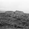
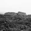
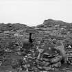
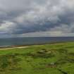
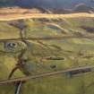
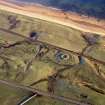
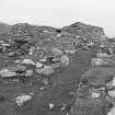
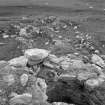
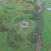
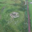
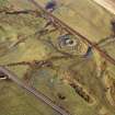
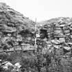
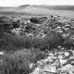
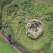
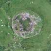
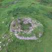
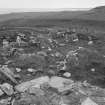
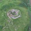
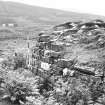
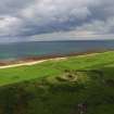
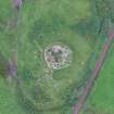
Kintradwell or Cinn Trolla Broch. This broch is situated on a natural terrace near the shore. When excavated, the entrance passage in the W side was found to be 7ft high at the outer end, but its floor is now covered with debris. At 6ft in from the outer end and again at 14ft in there is a contraction for a door- way. Between these two door checks a guard chamber opens on the right. Within the walls are two chambers, one of which contained a staircase of which 13 steps remain, mostly covered in debris. The broch has an interior diameter of 31ft and the height of the wall in the interior varies from 10ft to 15ft. It is 18ft thick at the entrance,and a scarcement runs round the inner face 8ft from the floor. A well, 7ft deep with steps leading into it, was found in the SE quadrant, close to the wall.
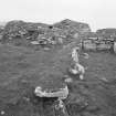
Outside the broch for a distance of 60ft from its base are the remains of irregularly built constructions connected by passages, with an access leading up to the entrance of the broch.
RCAHMS 1911, visited 1909.
Surveyed at 1:2500.
Visited by OS (W D J) 6 April 1962.
Cinn Trolla (name verified) is a broch, generally as described by the RCAHMS though its condition has deteriorated and the guard chamber is now deroofed.
Visited by OS (JB), 6 Dcember 1975.
Finds from the broch are in Dunrobin Museum: (Accession nos 1886.27-50; X90-100) Shale rings and discs (Accession nos X92-97 and 99-100a); a shale bead (Accession no X98) from either this broch or Backies broch (NC80SW 1). (Undated) information from TS of Catalogue of Dunrobin Museum, by A S Henshall.
Publication Account (2007)
NC90 1 KINTRADWELL ('Cinn Trolla', 'Clentrolla')
NC/9293 0807
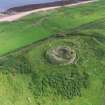
Solid-based broch in Loth, Sutherland, standing on flat ground a few miles to the south of Carn Liath (NC80 2) and on the same raised beach (visited 8/7/63, 1971 and Aug. 2003). It was excavated by Joass shortly before 1871 when he read an account of the work to the Society of Antiquaries of Scotland [3]. The interior and a number of outbuildings were then cleared out. Joass states that earlier the site had been a featureless green mound and the accidental discovery of the top of a corbelled mural cell in it provoked the explorations. However Stuart says that the broch had already been partially cleared out and that midden material, possibly derived from that clearance, was visible [7, 305]. If this is the “entire” broch in the parish of Loth referred to by the Rev. Alexander Pope in 1774 (see Suisgill, NC82 4) it may have been a lot better preserved a century before it was explored.
1. Description
The broch
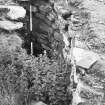
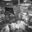
The outer face of the structure still stands about 2 m high in places, is built of rectangular sandstone blocks in regular courses and has a steep batter. The entrance is on the west side and is 2.14m (7ft) high at the outer end, with many of the lintels still in position. The passage is 92cm (3ft) wide and about 5.49m (18ft) long with rebated door-checks at 1.83m (6ft) and 4.27m (14ft) from the exterior; these doorways have stone sills set in the floor and the checks are faced with upright slabs which are projecting from the walls; the inner most left hand check is a built, rebated one. Another stone sill is described as being at the inner end of the passage but does not appear in the drawing or the plan. The passage has become partly filled again with stone blocks.
A round guard cell opens to the right between the two doorways and the sill of its doorway is 61cm (2ft) above the passage floor; the domed roof of the cell rose at least 1.53m (5ft) above the lintel of the doorway and its height to its capstone was given as 3.3m (11ft) originally. Now the wall around the cell is reduced to a height of less than 1.8m (6ft) and the corbelled dome has gone.
The Commission's photograph [5, pl. VII] shows that by 1909 the inner end of the passage had solid walling running across it instead of the usual void (everything above the lintel has since vanished) but this was almost certainly built some time after the excavations. Joass' drawing of the interior must have been done very soon after as some of the finds – mainly rotary querns – are shown arranged round the interior and all the features on the floor (below) are visible. This drawing shows clearly that the sides of the passage continue above the lintels – in other words there was the standard broch chamber over the entrance. The masonry was doubtless partly restored but it seems that Kintradwell was a true, hollow-walled broch.
The illustration also suggests that there were gaps between the lintels of the entrance passage – which were presumably meurtrières for defence against anyone attacking the door. This also tends to confirm that there was a chamber over the entrance opening into the interior.
Joass says that "the inner wall is faced to a height of 8 feet by a scarcement 1 foot thick" [3, 97], which sounds like a secondary wall, and the drawing of the interior con-firms that it is. The straight joint is still clearly visible). The same drawing shows no sign of a true scarcement in the primary wallface and neither is one visible now. It is possible that one did exist but was obscured by rebuilding after the excavation; for example one might suppose that the scarcement crossed the entrance passage at the height of the innermost lintel, which is preserved, but there is no sign of the feature in the drawing. Alternatively it might have been at the top of Level 2, as at Midhowe in Orkney (HY33 1). This seems more likely when one considers that, like Midhowe, Kintradwell contains many neat sandstone slabs the availability of which may have encouraged the builders to attempt great architectural sophistication.
There is an oval mural cell reached by a small, raised opening in the secondary inner wallface at 7 o'clock; the primary cell doorway is doubtless larger. The cell itself measures 3.36m (11ft) in length and is 3.05m (10ft) high.
The doorway to the mural stair is at 9 o'clock with its sill 1.22m (4ft) above the floor; the secondary facing does not appear ever to have blocked this opening. The stair rises to the right and there were 13 steps originally, now concealed by debris. The stair-foot guard cell is 3.05m (10ft) long and 2.75m (9ft) high and still has one lintel in position at its far end; this was presumably once part of the floor of the Level 2 intra-mural gallery. Although there are now no signs of this on the wallhead, and no such feature was mentioned by Joass, its existence may be assumed because of the chamber over the entrance.
At the time of excavation the deposits inside the tower were found to consist of an accumulation of 1.83m (6ft) of ash and earth floors on the original broch paving, with 1.83m (6ft) of stony debris on top of this. There was a fire-blackened stone slab lying flat in the centre, evidently a hearth, with nearby an L-shaped setting of long beach pebbles set on end in the floor. A heap of ashes and splintered bones lay within this. An area of 'double paving' was between this setting and the south wall.
In the floor of the central court, next to the wall on the south-east (at 12 o'clock), there is an underground chamber, diagnosed as a 'well', 2.14m (7ft) deep; steep steps, formed like a ladder, led down into it to within 92cm (3ft) of the bottom. Another floor chamber is near the wall at about 8 o'clock and was reported as having had clay-lined walls with 3 steps leading down into it on to a flagged (paved) base. The similarity with the underground chambers in neighbouring Carn Liath (NC80 2) is noteworthy. This broch is likewise situated on the raised beach close to the sea and with a fine view to the south-east across to Aberdeenshire, and it may be that here too the site came to have a more ceremonial function in the later stages of its use.
Secondary constructions
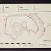
On the plan [3, pl. XII the south-east sector of the main wall is much thicker than the rest, and Joass explains that about a third of the outer face here has been rebuilt and thickened in much cruder masonry, the joint with the original face of the broch on the north-east being very poor. By contrast a low wall, “backed by stone detritus”, was built against the outer face of the broch from the west round to the north-east, and this is clearly secondary. It could well be composed of stones from the upper parts of the broch, stacked in this way after partial demolition.
The entrance – adjacent to the south end of this wall – has been extended outwards by a secondary passage which appears to have two door-frames close together a short distance in front of the broch. There is also, as at Carn Liath, a lateral passage here next to the broch wall and running along it in both directions. From the main passage a number of doorways lead into chambers of various shapes and sizes, some of which had upright stone pillars set into their floors. An approximately circular chamber is on the south-west, entered by two passages leading from the main extension passage. The absence of any stratigraphical analysis of the relative ages of these various outbuildings makes it difficult to assess the likely functions of the various chambers.
Joass suggested that all the external constructions were later than the broch, citing the poorer quality of the masonry; unlike the massive broch wall the stones of the outbuildings were small and had been packed with earthy midden material, including bones and shells.
2. Finds [6]
Metal objects include 1 iron spear, 1 iron dagger blade and a lead ring (all found with burials in wall chambers, on steps and in the topsoil), 1 piece of a smaller iron dagger blade and an iron chisel-shaped tool, both found in the outbuildings. No bronze was found but there were "fragments, greenish glazed, like portions of a crucible" [3, 102].
Bone artifacts: all these except one were on or near the broch floor and included 1 small blade, smooth and pointed; 2 socketed deer antler implements with transverse perforations (possibly bridle cheek-pieces), 1 'bow tip' of deer horn, 2 small spatulae and 1 whale vertebra cup.
Stone tools included many hammer-stones, some long pestles, mortars, about 50 querns and rubbers (the drawing [3, pl. XI] shows only rotary querns but the mention of rubbers probably indicates that saddle querns were found as well), 1 steatite cup, 1 flat pebble scratched on both faces, probably a strike-a-light, spindle whorls, 1 cup-marked sandstone block and several mortars, one with the pestle in it (two of these are marked in the large circular enclosure in the outbuildings). There were also 1 smooth mica-schist disc and fragments of "well finished" jet rings, presumably armlets.
A number of human burials were found in the broch ruins [3, 99], and these included: 1 skull 61cm (2ft) below the turf on top of the broch mound, 1 skeleton in a similar position, 1 headless skeleton 61cm (2ft) lower down and near the south wall (the skull was found later in its own small cist close to the inner end of the entrance), 1 fragmentary skeleton near the outer end of the entrance and 61cm (2ft) below the surface, fragments of 1 skull close under the roof of the stair-foot chamber, 2 skeletons on the intra-mural stair, fragments of a child's skull in the guard cell, and 1 skull vault and parts of a skeleton on the paved floor close to the entrance.
In the outbuildings more human remains were found and they included 1 skeleton with an iron spear-head and a small lead ring (noted earlier) nearby (found in a small chamber – “nearest on the left, looking from the broch doorway”), 2 skulls, in fragments, from the large circular enclosure south-west of the tower, and 1 skeleton in the shallow oval enclosure north-west of the tower with an iron dagger blade close by.
2. Dimensions (author's measurements)
External diameter from 6-12 o'clock 20.28m (66.5ft): 9-3 o'clock 19.83m (65ft) : internal diameters 9.00m (29.5ft) and 8.39 (27.5ft) respectively: wall proportion, from average dimensions, 56.6%. If Joass' plan is reasonably accurate the original thickness of the wall (subtracting 1ft. of “scarcement”) was about 4.58m (15ft) and the overall diameter about 18.91m (62ft) – giving an internal diameter of 9.76m (32ft).
In 1971 a fresh survey of the primary inner wallface showed that the inner court was very nearly circular, with a radius of 4.72 +/- 0.07m; thus the diameter of the court is 9.44m, or 30.95ft .
++
Sources: 1. NMRS site no. NC 90 SW 5: 2. Joass 1864: 3. Joass 1890: 4. Anderson 1883, 216: 5. RCAHMS 1911a, 160-61, no. 467 and pl. VII: 6. Proc Soc Antiq Scot 9 (1870-2), 53-6 (finds): 7. Stuart 1867: 8. Graham-Campbell and Paterson, forthcoming.
E W MacKie 2007


