
Pricing Change
New pricing for orders of material from this site will come into place shortly. Charges for supply of digital images, digitisation on demand, prints and licensing will be altered.
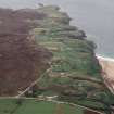
Strathy


Building(S) (Period Unassigned), Field System (Period Unassigned)
Site Name Strathy
Classification Building(S) (Period Unassigned), Field System (Period Unassigned)
Canmore ID 6878
Site Number NC86NW 20.04
NGR NC 833 658
Datum OSGB36 - NGR
Permalink http://canmore.org.uk/site/6878


- Council Highland
- Parish Farr
- Former Region Highland
- Former District Sutherland
- Former County Sutherland
NC86NW 20.04 c. 833 658.
NC 8303 6591. A grass and heather covered bank, 1.5m long NE-SW and 0.5m broad with some stone visible.
NC 8335 6603. A House 8m, E-W by 5m across, now comprising a grass-covered bank, 0.5m high, with stone, and a structure 10m by 5m attached to a length of wall, two courses high.
NC 8328 6590. Fieldwalls now comprising a grass covered bank of stone 56m long N-S by 0.5m wide by 0.75m high.
NC 8335 6590. Two circular grass-covered stone banks, 2.5m and 2m in diameter and 0.5m high, with central hollows,
NC 8327 6584. A rectangular structure, 10m E-W by 5m across by 0.5m to 1m high, grass-covered, with stone protruding. It has one internal division and a fieldwall to the north and west.
NC 8326 6569. A grass-covered, rectangular structur, 40m NW-SE by 8m, defined by stone banks 0.5m high. Two circular mounds of stone lie inside.
NC 8332 6571. A rectilinear grass-covered structure, 6m N-S by 2m across, defined by grass banks, 0.2m high with stones protruding. A fieldwall runs off it to the NW.
NC 8344 6572. A fieldwall consisting of a low, grass-covered bank with some stone, 20m long E-W, 0.1m high and 0.5m wide.
NC 8337 6566. A rectangular structure, 8m E-W, by 4m across, defined by grass-covered stone walls, 0.5m high.
NC 8330 6561. A fieldwall 20m long E-W, comprising a grass-covered stone bank, 0.25m high. There is at least one possible rectangular structure to the S and an amorphous green patch.
NC 8342 6561. A fieldwall, 60m long and 0.5m wide, now comprising a grass bank, 0.25m high, with many stones protruding.
NC 8300 6555. A fieldwall 80m long, N-S, and 0.5m wide, now comprising
a grass bank, 0.75m high, with stones protruding.
R J Mercer 1981.

