
Following the launch of trove.scot in February 2025 we are now planning the retiral of some of our webservices. Canmore will be switched off on 24th June 2025. Information about the closure can be found on the HES website: Retiral of HES web services | Historic Environment Scotland
Kirkhill, Fingask Drive, Cruck-framed Cottage


Cruck Framed Cottage (18th Century)
Site Name Kirkhill, Fingask Drive, Cruck-framed Cottage
Classification Cruck Framed Cottage (18th Century)
Alternative Name(s) Groam Cottages
Canmore ID 68547
Site Number NH54NE 24
NGR NH 5549 4570
Datum OSGB36 - NGR
Permalink http://canmore.org.uk/site/68547


- Council Highland
- Parish Kirkhill
- Former Region Highland
- Former District Inverness
- Former County Inverness-shire
NH54NE 24 555 456
See Architecture
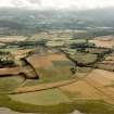
Behind the council houses there is an uninhabited 18th century cottage with very low walls and hipped gables, formerly thatched and now roofed with corrugated iron. In the aftermath of Culloden the MacDonald family who were resident at that time hid 2 fugitives under the rafters for about two months. This old building is under the threat of demolition.
D E Coghill et al 1989
TBS photos, 1989.
(Undated) information in NMRS.
Single storey rubble construction cottage with cruck-frame. Steeply pitched corrugated iron roof, originally a thatched roof. Abutted by single storey timber and corrugated iron roof building - advised by Highland Council as a bedroom added in the 20th century.
Reported to have been occupied until 1948 when the resident moved into one of the newly constructed council houses sitting adjacent. The cottage appears to have been one of a number of similar buildings collectively referred to as Groam Cottages, being described in the Ordnance Survey Name Book (1876-78) as "all one storey high, thatched and in ordinary repair. John Fraser Esq Achnagairn proprieter".
Field Visit (March 2022 - June 2022)
NH 5549 4570 In Spring 2022, almost 50 people investigated their local heritage using the ARCH ‘Community Timeline’ format, first by sharing memories, then researching various aspects of the local heritage, and finally creating a display, listing of sites and features, and binders of resources. The group took Kirkhill parish as their focus.
100 new entries, 61 updates, 177 photographs and 25 documents were submitted to the Highland HER, and eventually will be linked to Canmore, showing the wealth of information these community courses provide. As a result of the course, a new heritage group has formed, supported by Aird Community Trust.
The prehistoric past of the area has in many places been obliterated by agricultural improvements and forestry, but some key finds bear witness to occupation from the Neolithic times onwards. Before Culloden, much of the parish near the coast was marshy, but extraordinary drainage works took place in the later 1700s and first
half of the 1800s. There are even sea flaps at some reclaimed land.
Many of the lairds were keen planters, and some special trees survive in a number of sites. The walks at Reelig Glen were laid out in the late 1700s and first half of the 1800s, with many of the bridges and grotto still visible.
The Lovat estates were taken over by the government after Culloden. New ventures were introduced to improve profitability, including three short-lived limekilns, two of which still survive. A later venture near Reelig (Canmore ID: 316272; Highland HER: MHG24760) was on a larger scale, involving a tramway to bring the limestone from the quarry to the three large kilns.
In Kirkhill itself, the Wardlaw Mausoleum is well known. But less well known is Groam Cottage, an extremely rare example of an unmodernised 18th-century cruck-framed dwelling (Canmore 68547; Highland HER: MHG3076). It went from unlisted to Grade A protection in record time!
Wartime remains are scattered in the area as well. Very little remains of the First World War POW camp at Altnacardich where German POWs helped in forestry. More remains survive at the POW camp at Bunchrew Caravan Park, including a water tower and hut bases now used for caravans. Many of the large houses were taken over by military, including a large RAF presence at Lentran.
The project was able to build on the work of the Kilmorack Heritage Association, which undertook historical research in the early 2000s. In addition, participants were able to use the fantastic Lovat Estate maps, now available on the National Library of Scotland website. A rich collection of old photographs collected by Charlie Gair provided a wide-ranging archive of information spanning the 20th century.
The memories shared and research collected in lively sessions are now available on the Aird Community Trust website. The Trust will also make an online version of the display and the Charlie Gair photographic collection. Binders of resources are available at Inverness Reference Library and Wardlaw Mausoleum where the display is housed when not travelling.
www.airdcommunity.com/heritage-group/ https://maps.nls.uk/estates/invernessshire.html
Archive: Wardlaw Mausoleum, Inverness Library
Funders: Historic Environment Scotland, ARCH, Hugh Fraser Foundation, and numerous donations
Susan Kruse – Archaeology for Communities in the Highlands (ARCH)
(Source: DES Volume 23)

