Pricing Change
New pricing for orders of material from this site will come into place shortly. Charges for supply of digital images, digitisation on demand, prints and licensing will be altered.
Glasgow, Townhead Interchange (M8)
Motorway Interchange (20th Century)
Site Name Glasgow, Townhead Interchange (M8)
Classification Motorway Interchange (20th Century)
Alternative Name(s) Inner Ring Road
Canmore ID 68417
Site Number NS66NW 43
NGR NS 601 662
Datum OSGB36 - NGR
Permalink http://canmore.org.uk/site/68417
- Council Glasgow, City Of
- Parish Glasgow (City Of Glasgow)
- Former Region Strathclyde
- Former District City Of Glasgow
- Former County Lanarkshire
Publication Account (1997)
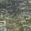
The first urban ring-road motorway in these islands, and the initial, component of Target 1 - a ten-year plan to build a 21-km network of primary roads to divert traffic from surface streets. Its daring ambitions were inspired by American president, yet it had to fit into the closely confined space of a European city - threaded through a narrow corridor opened up by Glasgow Corporation's slum-clearance - and only half of it was built. Highlights are the grade-separated complexity of Townhead Interchange, and the juxtaposition of the sunken artery of Charing Cross Section with soaring Kingston Bridge (now facing a major repair scheme). (Fig. 4.51).
Information from 'Rebuilding Scotland: The Postwar Vision, 1945-75', (1997).


