
Following the launch of trove.scot in February 2025 we are now planning the retiral of some of our webservices. Canmore will be switched off on 24th June 2025. Information about the closure can be found on the HES website: Retiral of HES web services | Historic Environment Scotland
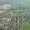
Roughcastle Opencast Coal And Fireclay Mine


Colliery (Period Unassigned), Fire Clay Mine (19th Century) - (20th Century), Open Cast Mine (Period Unassigned)
Site Name Roughcastle Opencast Coal And Fireclay Mine
Classification Colliery (Period Unassigned), Fire Clay Mine (19th Century) - (20th Century), Open Cast Mine (Period Unassigned)
Alternative Name(s) Bonnybridge; Falkirk
Canmore ID 68414
Site Number NS87NW 21
NGR NS 84414 79492
NGR Description Centred NS 84414 79492
Datum OSGB36 - NGR
Permalink http://canmore.org.uk/site/68414


- Council Falkirk
- Parish Falkirk
- Former Region Central
- Former District Falkirk
- Former County Stirlingshire

