
Pricing Change
New pricing for orders of material from this site will come into place shortly. Charges for supply of digital images, digitisation on demand, prints and licensing will be altered.
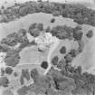
Greenock, East Hamilton Street Works


Engine Works (19th Century) - (20th Century)
Site Name Greenock, East Hamilton Street Works
Classification Engine Works (19th Century) - (20th Century)
Alternative Name(s) Main Street, John G Kincaid & Co Ltd, Kuaerner Kincaid Ltd
Canmore ID 68373
Site Number NS27NE 18
NGR NS 2932 7565
Datum OSGB36 - NGR
Permalink http://canmore.org.uk/site/68373


- Council Inverclyde
- Parish Greenock
- Former Region Strathclyde
- Former District Inverclyde
- Former County Renfrewshire
Project (May 2016 - September 2017)
Running from May 2016 to September 2017 and part of the Canmore Mapping Programme, Yard by Yard was an area-focused, desk-based project that tested the Defining Scotland’s Places (DSP) methodology in an area for which the records in the NRHE showed considerable variation from one historic map source to another.
Following discussions with local heritage groups and with the ambition of collecting data useful to the communities’ ambition to develop a coastal heritage trail, the project aimed to map the extent of the shipyards and associated industry between Port Glasgow and Greenock. To achieve this aim, the project used historic mapping, ortho-rectified modern aerial photography and the HES aerial photograph collection to map the extents of, and upgrade the records of, the shipyards and associated features such as quays, docks, areas of land reclamation and associated industry.
Note (22 June 2017)
This foundry, which is depicted on the 1st edition of the OS 25-inch map (Renfrew 1864, sheet II.6) and described in the contemporary Name Book (Renfrewshire vo. 8, page 29) as ‘An extensive Iron Founding establishment on the south side of East Hamilton Street’, was later incorporated into the Kinaird Engine Works.
Information from HES, Survey and Recording (AKK) 2 April 2017.

