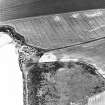
Accessibility

Font Size

100% 150% 200%

Background Colour

Default Contrast
Close Reset

New Mill

Pit(S) (Period Unknown), Ring Ditch House(S) (Prehistoric)

Site Name New Mill

Classification Pit(S) (Period Unknown), Ring Ditch House(S) (Prehistoric)

Canmore ID 68270

Site Number NO64NE 60

NGR NO 689 486

Datum OSGB36 - NGR

Permalink http://canmore.org.uk/site/68270

Ordnance Survey licence number AC0000807262. All rights reserved.
Canmore Disclaimer. © Bluesky International Limited 2025. Public Sector Viewing Terms

Toggle Aerial | View on large map

Digital Images

Oblique aerial view centred on the cropmarks of the unenclosed settlement, ring ditches and pits at Newmill with the mill house adjacent, looking to the WSW.
Oblique aerial view centred on the cropmarks of the unenclosed settlement, ring ditches and pits at Newmill with the mill house adjacent, looking to the WSW.Oblique aerial view.Corbie Knowe, oblique aerial view, taken from the NNW, showing a mound and a possible enclosure, a building and two areas with anti-tank-blocks. Cropmarks and pits are visible in the top right-hand corner of the photograph.Oblique aerial view.Oblique aerial view centred on the cropmarks of the unenclosed settlement, ring ditches and pits at Newmill, looking to the NE.

Administrative Areas

  • Council Angus
  • Parish Inverkeilor
  • Former Region Tayside
  • Former District Angus
  • Former County Angus

References

MyCanmore Image Contributions


Contribute an Image

MyCanmore Text Contributions