Pricing Change
New pricing for orders of material from this site will come into place shortly. Charges for supply of digital images, digitisation on demand, prints and licensing will be altered.
Upcoming Maintenance
Please be advised that this website will undergo scheduled maintenance on the following dates:
Thursday, 9 January: 11:00 AM - 3:00 PM
Thursday, 23 January: 11:00 AM - 3:00 PM
Thursday, 30 January: 11:00 AM - 3:00 PM
During these times, some functionality such as image purchasing may be temporarily unavailable. We apologise for any inconvenience this may cause.
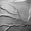
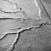
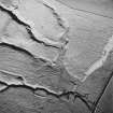
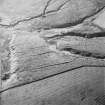
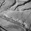
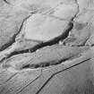
Pinglehole Tower
Enclosure(S) (Period Unassigned), Field Boundary(S) (Period Unassigned), Ring Enclosure(S) (Period Unassigned), Sheepfold (Period Unassigned), Tower House (Medieval)(Possible)
Site Name Pinglehole Tower
Classification Enclosure(S) (Period Unassigned), Field Boundary(S) (Period Unassigned), Ring Enclosure(S) (Period Unassigned), Sheepfold (Period Unassigned), Tower House (Medieval)(Possible)
Alternative Name(s) Pingillholls
Canmore ID 67982
Site Number NY59NE 8
NGR NY 5570 9626
Datum OSGB36 - NGR
Permalink http://canmore.org.uk/site/67982
- Council Scottish Borders, The
- Parish Castleton
- Former Region Borders
- Former District Roxburgh
- Former County Roxburghshire
NY59NE 8 c.5570 9626.
(Area centred NY 55709626) 'Pingillholls' with tower symbol on Ponts map of Liddesdale (1608).


