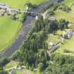
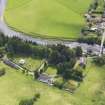
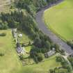
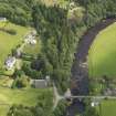
Bentpath, Westerkirk, Old Parish Church
Burial Ground (Medieval) - (Post Medieval), Church (Medieval)
Site Name Bentpath, Westerkirk, Old Parish Church
Classification Burial Ground (Medieval) - (Post Medieval), Church (Medieval)
Alternative Name(s) Westerkirk, Old Graveyard
Canmore ID 67816
Site Number NY39SW 18.01
NGR NY 3127 9033
NGR Description NY 31270 90331
Datum OSGB36 - NGR
Permalink http://canmore.org.uk/site/67816
- Council Dumfries And Galloway
- Parish Westerkirk
- Former Region Dumfries And Galloway
- Former District Annandale And Eskdale
- Former County Dumfries-shire
NY39SW 18.01 3127 9033.
(NY 3127 9033) Church (NR) (Site of)
OS 6" map (1957)
For present parish church (NY 3118 9031), see NY39SW 18.00.
The present parish church of Westerkirk was built in 1888 (TSA 1962). Its predecessor, noted in the ONB as 'rebuilt in 1788' and extant in 1857, stood at the site indicated; (it was presumably demolished when the present church was built). A chapel of Westerkirk is mentioned in 1391 and 1459 (OSA 1794). TSA refers to church records dating back to 1693.
OSA; Name Book 1857; TSA.
The parish of Westerkirk was formerly known as Westerker.
H Scott 1915-61.
Westerkirk (Glasgow, Eskdale/Annandale) was granted to Melrose by John de Graham, lord of Westerkirk, and confirmed to the abbey by Robert I in 1321, this church with all its teinds was granted to the uses of the abbey in that same year by the chapter of Glasgow cathedral. The abbey already possessed teinds in Eskdalemuir granted to them by Robert Avenel, and confirmed to them by Herbert, bishop of Glasgow (1147-64) while in 1305 an agreement over the chapel of Watcarrick took place between the abbey and the parson of Westerkirk. This grant now consolidated these interests, it being conceded in a further confirmation by John, bishop of Glasgow, that the church might be served by a chaplain. Both parsonage and vicarage revenues thus accrued to the monastery, as they continued to do at the Reformation, although these were 'out of use of payment' at that period.
I B Cowan 1967
No further information. No remains of the church exist.
Visited by OS (MJF) 1 September 1979.
Field Visit (August 1980)
Westerkirk, Old Parish Church and Burial-ground NY 312 903 NY39SW 2
Nothing now remains of the medieval parish church of Westerkirk, mentioned in the early 14th century, or of a church built in 1788, both of which probably stood in the burial-ground 70m ENE of the modern parish church (built in 1888).
RCAHMS 1980, visited August 1980
(Stat. Acct, xi, 1794, 514-5, 524; Armstrong 1883, 95-9; Hyslop and Hyslop 1912, 475-80; Cowan 1967, 208)
Field Visit (June 1993)
NY39SW 18.01 3127 9033.
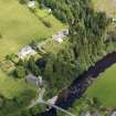
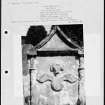
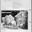
Nothing is visible of the old parish church of Westerkirk, although it probably occupied much the same site in the burial-ground as the Johnstone (Adam) Mausoleum (NY39SW 18.02). A dormer pediment and fragments of two 17th-century graveslabs have been built into the N wall of the burial-ground; within the burial-ground there are a number of 18th-century gravestones.
Visited by RCAHMS (IMS), June 1993.
Note (15 March 2024)
A church and burial ground is depicted on the 1st edition of the OS 6-inch map (1862).
Information from HES (D Watson) 15 March 2024


