
Douglas Farm


Field System (Iron Age), Plantation Bank (Post Medieval), Settlement (Iron Age)
Site Name Douglas Farm
Classification Field System (Iron Age), Plantation Bank (Post Medieval), Settlement (Iron Age)
Alternative Name(s) Wardens Dykes; Boghead; The Bracken; Gretna Services Area
Canmore ID 67433
Site Number NY36NW 18
NGR NY 30305 68887
Datum OSGB36 - NGR
Permalink http://canmore.org.uk/site/67433


- Council Dumfries And Galloway
- Parish Gretna
- Former Region Dumfries And Galloway
- Former District Annandale And Eskdale
- Former County Dumfries-shire
NY36NW 18 3031 6889.
(NY 3031 6889) Earthwork (NR)
OS 6" map (1957)
Fort, probably that called the Wardens Dykes.
(Information from O G S Crawford, undated)
RCAHMS 1920; W Macfarlane 1909
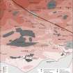
This earthwork occupies a non-defensive position on a slight ridge. Oval on plan, it measures 54.0m from NE to SW by 42.0m transversely within two earth and stone banks with a medial ditch. There are two breaks in the banks, one in the E and the other almost directly opposite, in the W. It is difficult to ascertain which is the original entrance. Although the outer bank is intact at the latter there is a distinct causeway across the ditch. The break in the E side is narrow and is probably associated with the relatively recent track which crosses the centre of the earthwork. Although the interior is featureless apart from a small mound about 6.0 m in diameter by 0.3 m high, in the SW segment, this is almost certainly a settlement.
Resurveyed at 1:2500.
Visited by OS (RD) 19 June 1970
Statistical Account (OSA) 1794
No change to the previous field report.
Visited by OS (JP) 20 February 1973.
Parts of an extensive sub-rectangular field system have been revealed as cropmarks on both sides of the A 74 immediately N of this settlement. There is no trace of it on the ground. Copies of the aerial photographs, taken by G D B Jones are lodged in Dumfries Museum and NMRS.
Information from G D B Jones letter to G Maxwell, RCAHMS, 4 July 1980.
B Jones 1979.
The rebuilding of the THF/BP service station necessitated the investigation of this field system. This investigation consisted initially of geophysical survey using both resistivity and magnetometry followed by trial trenching using a JCB. The results of the geophysical survey indicated archaeological features additional to those apparent in the aerial photograph. The trial trenches confirmed this, revealing a large spread of black organic soil with lenses of grey and white clay against a background of red sandstone-derived sandy clay.
Excavation was undertaken in January-March 1992 by GUARD of the features revealed. The larger area incorporated within the excavation trench revealed a large number of features. There were over one hundred post holes, roughly twenty large pits, four major boundary ditches, three minor ditches, two major cobbled areas and a roadway leading to the adjacent enclosure of Warden's Dyke. There were also ephemeral traces of two rectilineal structures shown by shallow cuts, truncated by one of the major ditches. Find recovery was very low; the entire artefactual assemblage consisted of nine lithics, of which three were surface finds without context.
The analysis of the site is currently ongoing, so interpretation is at an early stage. However the remains have been divided into five rough chronological categories on stratigraphic grounds.
Phase I consisted of the two rectilineal cuts.
Phase II included both the rodaway and the major ditches.
Phase III consisted of the re-cut of two of the major ditches and the activity represented by the post holes and pits.
Phase IV consisted of thre laying of the cobbled areas, while
Phase V consisted of the digging of the minor ditches.
These rough phases will be re-assessed during the post-excavation analysis and may be combined or further subdivided.
Sponsors: BP Oil UK Ltd, Welcome Break, Trusthouse Forte.
I Banks 1992.
Scheduled as 'The Bracken, enclosed settlement and droveway 370m WSW of... an enclosed settlement and ditched droveway... in an area of improved pasture to the NW of Gretna services Area, just below the summit of a low ridge on a gentle NW-facing slope.'
Information from Historic Scotland, scheduling document dated 19 December 2007.
Field Visit (December 1980)
(No. 41) Douglas Farm NY 303 688 NY36NW 18
This settlement, also known as Wardens Dykes, is situated in a plantation 50m SSW of the Carlisle to Glasgow road (A74). Oval on plan, it measures about 54m by 42m within two banks and medial ditch. On the N, E and W there is a possible outer ditch, but this may have been dug to provide material for a plantation bank which caps the outer bank. The entrance is on the NW, and the interior, which is crossed by a track, contains a mound of recent date. For a field-system nearby see NY63NW 18.
RCAHMS 1981, visited December 1980
(RCAHMS 1920, p. 92, No. 262)
Field Visit (December 1980)
(No. 80) Douglas Farm NY 303 689 NY36NW
Parts of a field-system have been revealed as cropmarks on both sides of the A74 immediately N of Douglas farm settlement (NY36NW 18).
RCAHMS 1981, visited December 1980
Aerial Photographic Transcription (18 January 1984 - 23 January 1991)
An aerial transcription was produced from oblique aerial photographs. Information from Historic Environment Scotland (BM) 31 March 2017.
Excavation (January 1992 - March 1992)
The rebuilding of the THF/BP service station necessitated the investigation of this field system. This investigation consisted initially of geophysical survey using both resistivity and magnetometry followed by trial trenching using a JCB. The results of the geophysical survey indicated archaeological features additional to those apparent in the aerial photograph. The trial trenches confirmed this, revealing a large spread of black organic soil with lenses of grey and white clay against a background of red sandstone-derived sandy clay.
Excavation was undertaken in January-March 1992 by GUARD of the features revealed. The larger area incorporated within the excavation trench revealed a large number of features. There were over one hundred post holes, roughly twenty large pits, four major boundary ditches, three minor ditches, two major cobbled areas and a roadway leading to the adjacent enclosure of Warden's Dyke. There were also ephemeral traces of two rectilineal structures shown by shallow cuts, truncated by one of the major ditches. Find recovery was very low; the entire artefactual assemblage consisted of nine lithics, of which three were surface finds without context.
The analysis of the site is currently ongoing, so interpretation is at an early stage. However the remains have been divided into five rough chronological categories on stratigraphic grounds.
Phase I consisted of the two rectilineal cuts.
Phase II included both the rodaway and the major ditches.
Phase III consisted of the re-cut of two of the major ditches and the activity represented by the post holes and pits.
Phase IV consisted of thre laying of the cobbled areas, while
Phase V consisted of the digging of the minor ditches.
These rough phases will be re-assessed during the post-excavation analysis and may be combined or further subdivided.
Sponsors: BP Oil UK Ltd, Welcome Break, Trusthouse Forte.
I Banks 1992.
Note (1997)
NY 3031 6889 NY36NW 18
Douglas farm. Listed as defended settlement and linear ditches.
RCAHMS 1997.
Note (2 July 2014 - 23 May 2016)
This fort or fortified settlement is situated on a low hill immediately WNW of the Gretna motorway service area. Oval on plan, it measures 54m from NE to SW by 42m transversely within twin ramparts with a medial ditch, and the entrance is on the NW. A second gap in the defences on the E is thought to be where a relatively modern track has crossed the fort and the only other feature visible within the interior is probably a relatively recent mound some 6m across. During the 19th century the enclosure was planted with trees and the defences are heavily reduced; the counterscarp rampart is capped by the old plantation bank which was probably accompanied by an external ditch.
Information from An Atlas of Hillforts of Great Britain and Ireland – 23 May 2016. Atlas of Hillforts SC1116

