|
Prints and Drawings |
DC 32172 |
Records of the Royal Commission on the Ancient and Historical Monuments of Scotland (RCAHMS), Edinbu |
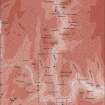
Upper Eskdale landscape case-study area: map showing the prehistoric monuments, with windows for maps of Bailiehill and Raeburnfoot. Published in Eastern Dumfriesshire: an archaeological landscape. |
11/1996 |
Item Level |
|
 |
On-line Digital Images |
SC 1917405 |
Records of the Royal Commission on the Ancient and Historical Monuments of Scotland (RCAHMS), Edinbu |
Upper Eskdale landscape case-study area: map showing the prehistoric monuments, with windows for maps of Bailiehill and Raeburnfoot. Published in Eastern Dumfriesshire: an archaeological landscape. |
11/1996 |
Item Level |
|
|
Digital Files (Non-image) |
GV 007435 |
Records of the Royal Commission on the Ancient and Historical Monuments of Scotland (RCAHMS), Edinbu |
Upper Eskdale landscape case-study area: map showing the prehistoric monuments, with windows for maps of Bailiehill and Raeburnfoot. Published in Eastern Dumfriesshire: an archaeological landscape. |
11/1996 |
Item Level |
|
 |
On-line Digital Images |
SC 2472172 |
Records of the Ordnance Survey, Southampton, Hampshire, England |
Hamlin Knowe, NY29SW 28, Ordnance Survey index card, page number 1, Recto |
c. 1958 |
Item Level |
|


