Accessibility

Font Size

100% 150% 200%

Background Colour

Default Contrast
Close Reset

Clerk Hill

Ring Enclosure(S) (Post Medieval)

Site Name Clerk Hill

Classification Ring Enclosure(S) (Post Medieval)

Canmore ID 67260

Site Number NY29NE 37

NGR NY 2591 9955

Datum OSGB36 - NGR

Permalink http://canmore.org.uk/site/67260

Ordnance Survey licence number AC0000807262. All rights reserved.
Canmore Disclaimer. © Bluesky International Limited 2025. Public Sector Viewing Terms

Toggle Aerial | View on large map

Digital Images

Oblique aerial view.
Oblique aerial view.Clerk Hill, NY29NE 37, Ordnance Survey index card, RectoUpper Eskdale landscape case-study area: map showing the medieval and later monuments and the locations of the farms known to have existed in the 18th century (with windows for maps of Bailiehill and Raeburnfoot).Published in Eastern Dumfriesshire: an archaeological landscape.

Administrative Areas

  • Council Dumfries And Galloway
  • Parish Eskdalemuir
  • Former Region Dumfries And Galloway
  • Former District Annandale And Eskdale
  • Former County Dumfries-shire

Activities

Field Visit (June 1992)

NY29NE 37 2592 9956

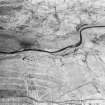
On the lower NNW flank of Clerk Hill, there is a cluster of at least eight ring-enclosures. They range in size between 3.9m and 6.8m in diameter within banks measuring between 1.3m and 2.1m in thickness and up to 0.3m in height, and have external ditches between 1.3m and 1.8m broad.

Visited by RCAHMS (IMS, PC), June 1992.

References

MyCanmore Image Contributions


Contribute an Image

MyCanmore Text Contributions