
Highstenries


Farmhouse (18th Century)
Site Name Highstenries
Classification Farmhouse (18th Century)
Alternative Name(s) High Stenries; Highstone Ridge
Canmore ID 67065
Site Number NY27NE 9
NGR NY 29023 76992
Datum OSGB36 - NGR
Permalink http://canmore.org.uk/site/67065
Ordnance Survey licence number AC0000807262. All rights reserved.
Canmore Disclaimer.
© Copyright and database right 2024.
- Correction
- Favourite

SC 2145560
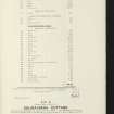
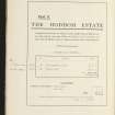
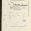
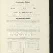
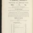
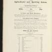
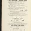
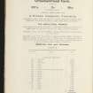
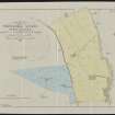
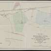
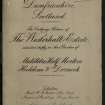
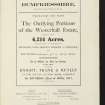
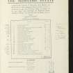
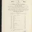
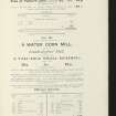
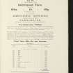
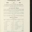
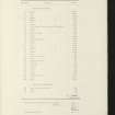
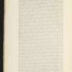
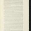
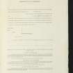
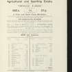
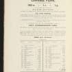
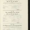
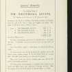
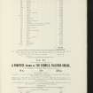
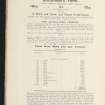
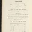
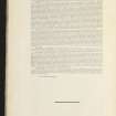
Estate Exchange. Westerhall Estate. No 1498, Sale brochure
Collection of sale catalogues relating to Scottish estates
22/4/1911
© Courtesy of HES (Estates Exchange collection)

SC 2145573
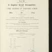
Estate Exchange. Westerhall Estate. No 1498, Sale brochure
Collection of sale catalogues relating to Scottish estates
22/4/1911
© Courtesy of HES (Estates Exchange collection)

SC 2145577
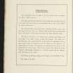
Estate Exchange. Westerhall Estate. No 1498, Sale brochure
Collection of sale catalogues relating to Scottish estates
22/4/1911
© Courtesy of HES (Estates Exchange collection)

SC 2145580
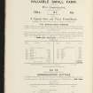
Estate Exchange. Westerhall Estate. No 1498, Sale brochure
Collection of sale catalogues relating to Scottish estates
22/4/1911
© Courtesy of HES (Estates Exchange collection)

SC 2145591
Estate Exchange. Westerhall Estate. No 1498, Sale brochure
Collection of sale catalogues relating to Scottish estates
22/4/1911
© Courtesy of HES (Estates Exchange collection)

SC 2145559
Estate Exchange. Westerhall Estate. No 1498, Sale brochure
Collection of sale catalogues relating to Scottish estates
22/4/1911
© Courtesy of HES (Estates Exchange collection)

SC 2145567
Estate Exchange. Westerhall Estate. No 1498, Sale brochure
Collection of sale catalogues relating to Scottish estates
22/4/1911
© Courtesy of HES (Estates Exchange collection)

SC 2145569
Estate Exchange. Westerhall Estate. No 1498, Sale brochure
Collection of sale catalogues relating to Scottish estates
22/4/1911
© Courtesy of HES (Estates Exchange collection)

SC 2145571
Estate Exchange. Westerhall Estate. No 1498, Sale brochure
Collection of sale catalogues relating to Scottish estates
22/4/1911
© Courtesy of HES (Estates Exchange collection)

SC 2145578
Estate Exchange. Westerhall Estate. No 1498, Sale brochure
Collection of sale catalogues relating to Scottish estates
22/4/1911
© Courtesy of HES (Estates Exchange collection)

SC 2145555
Estate Exchange. Westerhall Estate. No 1498, Sale brochure
Collection of sale catalogues relating to Scottish estates
22/4/1911
© Courtesy of HES (Estates Exchange collection)

SC 2145565
Estate Exchange. Westerhall Estate. No 1498, Sale brochure
Collection of sale catalogues relating to Scottish estates
22/4/1911
© Courtesy of HES (Estates Exchange collection)

SC 2145582
Estate Exchange. Westerhall Estate. No 1498, Sale brochure
Collection of sale catalogues relating to Scottish estates
22/4/1911
© Courtesy of HES (Estates Exchange collection)

SC 2145589
Estate Exchange. Westerhall Estate. No 1498, Sale brochure
Collection of sale catalogues relating to Scottish estates
22/4/1911
© Courtesy of HES (Estates Exchange collection)

SC 2145590
Estate Exchange. Westerhall Estate. No 1498, Sale brochure
Collection of sale catalogues relating to Scottish estates
22/4/1911
© Courtesy of HES (Estates Exchange collection)

SC 2145550
Estate Exchange. Westerhall Estate. No 1498, Sale brochure
Collection of sale catalogues relating to Scottish estates
22/4/1911
© Courtesy of HES (Estates Exchange collection)

SC 2145552
Estate Exchange. Westerhall Estate. No 1498, Sale brochure
Collection of sale catalogues relating to Scottish estates
22/4/1911
© Courtesy of HES (Estates Exchange collection)

SC 2145553
Estate Exchange. Westerhall Estate. No 1498, Sale brochure
Collection of sale catalogues relating to Scottish estates
22/4/1911
© Courtesy of HES (Estates Exchange collection)

SC 2145556
Estate Exchange. Westerhall Estate. No 1498, Sale brochure
Collection of sale catalogues relating to Scottish estates
22/4/1911
© Courtesy of HES (Estates Exchange collection)

SC 2145561
Estate Exchange. Westerhall Estate. No 1498, Sale brochure
Collection of sale catalogues relating to Scottish estates
22/4/1911
© Courtesy of HES (Estates Exchange collection)

SC 2145564
Estate Exchange. Westerhall Estate. No 1498, Sale brochure
Collection of sale catalogues relating to Scottish estates
22/4/1911
© Courtesy of HES (Estates Exchange collection)

SC 2145574
Estate Exchange. Westerhall Estate. No 1498, Sale brochure
Collection of sale catalogues relating to Scottish estates
22/4/1911
© Courtesy of HES (Estates Exchange collection)

SC 1631941
View of steading.
List C Survey
1975
© Crown Copyright: HES (List C Survey)

SC 2145570
Estate Exchange. Westerhall Estate. No 1498, Sale brochure
Collection of sale catalogues relating to Scottish estates
22/4/1911
© Courtesy of HES (Estates Exchange collection)

SC 2145576
Estate Exchange. Westerhall Estate. No 1498, Sale brochure
Collection of sale catalogues relating to Scottish estates
22/4/1911
© Courtesy of HES (Estates Exchange collection)

SC 2145583
Estate Exchange. Westerhall Estate. No 1498, Sale brochure
Collection of sale catalogues relating to Scottish estates
22/4/1911
© Courtesy of HES (Estates Exchange collection)

SC 2145584
Estate Exchange. Westerhall Estate. No 1498, Sale brochure
Collection of sale catalogues relating to Scottish estates
22/4/1911
© Courtesy of HES (Estates Exchange collection)

SC 2145586
Estate Exchange. Westerhall Estate. No 1498, Sale brochure
Collection of sale catalogues relating to Scottish estates
22/4/1911
© Courtesy of HES (Estates Exchange collection)

SC 2145592
Estate Exchange. Westerhall Estate. No 1498, Sale brochure
Collection of sale catalogues relating to Scottish estates
22/4/1911
© Courtesy of HES (Estates Exchange collection)

SC 2145551
Estate Exchange. Westerhall Estate. No 1498, Sale brochure
Collection of sale catalogues relating to Scottish estates
22/4/1911
© Courtesy of HES (Estates Exchange collection)

SC 2145558
Estate Exchange. Westerhall Estate. No 1498, Sale brochure
Collection of sale catalogues relating to Scottish estates
22/4/1911
© Courtesy of HES (Estates Exchange collection)

SC 2145563
Estate Exchange. Westerhall Estate. No 1498, Sale brochure
Collection of sale catalogues relating to Scottish estates
22/4/1911
© Courtesy of HES (Estates Exchange collection)

SC 2145572
Estate Exchange. Westerhall Estate. No 1498, Sale brochure
Collection of sale catalogues relating to Scottish estates
22/4/1911
© Courtesy of HES (Estates Exchange collection)

SC 2471403
Highstenries, NY27NE 9, Ordnance Survey index card, Recto
Records of the Ordnance Survey, Southampton, Hampshire, England
1958
© Crown Copyright: HES (Ordnance Survey Archaeology Division Collection)

SC 2145554
Estate Exchange. Westerhall Estate. No 1498, Sale brochure
Collection of sale catalogues relating to Scottish estates
22/4/1911
© Courtesy of HES (Estates Exchange collection)

SC 2145568
Estate Exchange. Westerhall Estate. No 1498, Sale brochure
Collection of sale catalogues relating to Scottish estates
22/4/1911
© Courtesy of HES (Estates Exchange collection)

SC 2145579
Estate Exchange. Westerhall Estate. No 1498, Sale brochure
Collection of sale catalogues relating to Scottish estates
22/4/1911
© Courtesy of HES (Estates Exchange collection)

SC 2145581
Estate Exchange. Westerhall Estate. No 1498, Sale brochure
Collection of sale catalogues relating to Scottish estates
22/4/1911
© Courtesy of HES (Estates Exchange collection)

SC 2145585
Estate Exchange. Westerhall Estate. No 1498, Sale brochure
Collection of sale catalogues relating to Scottish estates
22/4/1911
© Courtesy of HES (Estates Exchange collection)


SC 2145557
Estate Exchange. Westerhall Estate. No 1498, Sale brochure
Collection of sale catalogues relating to Scottish estates
22/4/1911
© Courtesy of HES (Estates Exchange collection)

SC 2145562
Estate Exchange. Westerhall Estate. No 1498, Sale brochure
Collection of sale catalogues relating to Scottish estates
22/4/1911
© Courtesy of HES (Estates Exchange collection)

SC 2145566
Estate Exchange. Westerhall Estate. No 1498, Sale brochure
Collection of sale catalogues relating to Scottish estates
22/4/1911
© Courtesy of HES (Estates Exchange collection)

SC 2145575
Estate Exchange. Westerhall Estate. No 1498, Sale brochure
Collection of sale catalogues relating to Scottish estates
22/4/1911
© Courtesy of HES (Estates Exchange collection)

SC 2145587
Estate Exchange. Westerhall Estate. No 1498, Sale brochure
Collection of sale catalogues relating to Scottish estates
22/4/1911
© Courtesy of HES (Estates Exchange collection)

SC 2145588
Estate Exchange. Westerhall Estate. No 1498, Sale brochure
Collection of sale catalogues relating to Scottish estates
22/4/1911
© Courtesy of HES (Estates Exchange collection)


- Council Dumfries And Galloway
- Parish Half Morton
- Former Region Dumfries And Galloway
- Former District Annandale And Eskdale
- Former County Dumfries-shire
NY27NE 9.00 29023 76992
NY27NE 9.01 28994 76994 Farmsteading, West Range
NY27NE 9.02 29027 77003 Farmsteading, East Range

