
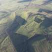
Burnswark


Farmhouse (19th Century)
Site Name Burnswark
Classification Farmhouse (19th Century)
Alternative Name(s) Burnswark Farmhouse
Canmore ID 66631
Site Number NY17NE 22
NGR NY 19261 78919
Datum OSGB36 - NGR
Permalink http://canmore.org.uk/site/66631


- Council Dumfries And Galloway
- Parish Hoddom
- Former Region Dumfries And Galloway
- Former District Annandale And Eskdale
- Former County Dumfries-shire
NY17NE 22.00 NY 19261 78919
NY17NE 22.01 NY 19252 78938 Farmsteading, E Range
NY17NE 22.02 NY 19230 78942 Farmsteading, SW Range
NY17NE 22.03 NY 19231 78961 Farmsteading, NW Range
NY17NE 22.04 NY 19241 78943 Farmsteading, Central Range

