 |
On-line Digital Images |
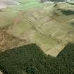
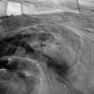
SC 337226 |
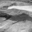
RCAHMS Aerial Photography |
Oblique aerial view. |
1990 |
Item Level |
|
 |
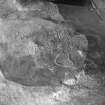
On-line Digital Images |
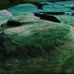
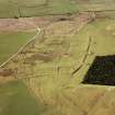
SC 337305 |
RCAHMS Aerial Photography |
Oblique aerial view. |
1990 |
Item Level |
|
 |
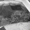
On-line Digital Images |
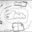
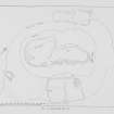
SC 343849 |
Records of the Royal Commission on the Ancient and Historical Monuments of Scotland (RCAHMS), Edinbu |
Ink drawing; site plan of Burnswark showing Roman and native works (draft) |
1915 |
Item Level |
|
 |
On-line Digital Images |
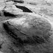
SC 349444 |
RCAHMS Aerial Photography |
Oblique aerial view. |
1990 |
Item Level |
|
 |
On-line Digital Images |
SC 349445 |
RCAHMS Aerial Photography |
Oblique aerial view of Burnswark Roman Fort, seigeworks and other features. |
1990 |
Item Level |
|
 |
On-line Digital Images |
SC 359724 |
RCAHMS Aerial Photography |
Oblique aerial view. |
1989 |
Item Level |
|
 |
On-line Digital Images |
SC 373362 |
RCAHMS Aerial Photography |
Oblique aerial view. |
1989 |
Item Level |
|
 |
On-line Digital Images |
SC 373536 |
RCAHMS Aerial Photography |
Oblique aerial view of Burnswark Roman Fort, siegeworks and other sites. |
1990 |
Item Level |
|
 |
On-line Digital Images |
SC 379142 |
RCAHMS Aerial Photography |
Oblique aerial view. |
|
Item Level |
|
 |
On-line Digital Images |
SC 1073135 |
RCAHMS Aerial Photography |
Oblique aerial view. |
1990 |
Item Level |
|
 |
On-line Digital Images |
DP 047893 |
|
Plan showing fortifications.
Titled: 'Birrenswark'. |
c. 1920 |
Item Level |
|
 |
On-line Digital Images |
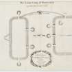
DP 070817 |
General Collection |
Plan of Burnswark Roman Fort and seige earthworks from Alexander Gordon's 'Itinerarium septentrionale'. |
1726 |
Item Level |
|
 |
On-line Digital Images |
SC 1164088 |
RCAHMS Aerial Photography |
Oblique aerial view. |
1990 |
Item Level |
|
 |
On-line Digital Images |
SC 1164089 |
RCAHMS Aerial Photography |
Oblique aerial view. |
1990 |
Item Level |
|
 |
On-line Digital Images |
SC 1234182 |
RCAHMS Aerial Photography |
Oblique aerial photograph |
1990 |
Item Level |
|
![Map of the earthworks in the landscape around Burnswark: publication drawing for Inventory of Eastern Dumfriesshire, generated from computer file 5BURNSW.PM6. Unattributed, [1996].](//i.rcahms.gov.uk/canmore/s/SC01239704.jpg) |
On-line Digital Images |
SC 1239704 |
Records of the Royal Commission on the Ancient and Historical Monuments of Scotland (RCAHMS), Edinbu |
Map of the earthworks in the landscape around Burnswark: publication drawing for Inventory of Eastern Dumfriesshire, generated from computer file 5BURNSW.PM6. Unattributed, [1996]. |
1996 |
Item Level |
|
 |
On-line Digital Images |
SC 1759842 |
RCAHMS Aerial Photography |
Oblique aerial view. |
1989 |
Item Level |
|
 |
On-line Digital Images |
SC 1759843 |
RCAHMS Aerial Photography |
Oblique aerial view. |
1989 |
Item Level |
|
 |
On-line Digital Images |
SC 1759844 |
RCAHMS Aerial Photography |
Oblique aerial view. |
1989 |
Item Level |
|
 |
On-line Digital Images |
SC 1759845 |
RCAHMS Aerial Photography |
Oblique aerial view. |
1989 |
Item Level |
|
 |
On-line Digital Images |
SC 1759846 |
RCAHMS Aerial Photography |
Oblique aerial view. |
1989 |
Item Level |
|
 |
On-line Digital Images |
SC 1759847 |
RCAHMS Aerial Photography |
Oblique aerial view. |
1989 |
Item Level |
|
 |
On-line Digital Images |
SC 1759848 |
RCAHMS Aerial Photography |
Oblique aerial view. |
1989 |
Item Level |
|
 |
On-line Digital Images |
SC 1759849 |
RCAHMS Aerial Photography |
Oblique aerial view. |
1989 |
Item Level |
|


