
Following the launch of trove.scot in February 2025 we are now planning the retiral of some of our webservices. Canmore will be switched off on 24th June 2025. Information about the closure can be found on the HES website: Retiral of HES web services | Historic Environment Scotland
Annanfoot


Temporary Camp (Roman)
Site Name Annanfoot
Classification Temporary Camp (Roman)
Alternative Name(s) Newbie
Canmore ID 66471
Site Number NY16NE 22
NGR NY 18031 65266
NGR Description Centred NY 18031 65266
Datum OSGB36 - NGR
Permalink http://canmore.org.uk/site/66471


- Council Dumfries And Galloway
- Parish Annan
- Former Region Dumfries And Galloway
- Former District Annandale And Eskdale
- Former County Dumfries-shire
NY16NE 22 centred 1802 6526
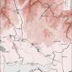
NY 1802 6526 (Information from G D B Jones letter 17 November 1977) Aerial photography has established the presence of a 8 or 9 acre fort on the west side of the R Annan close to its confluence with the Solway Estuary, Dumfries.
Daily Telegraph, 9 November 1977
Not a fort but a temporary camp.
Information from G S Maxwell, RCAHMS, 26 April 1985
The temporary camp discovered at Annanfoot on the right bank of the River Annan near its mouth and opposite the town of Annan, has been associated with early coastal or marine operations conducted by Agricola. The entire W side some 260m long and not more than about 100m of the N and S sides can be seen as crop-marks, but the E side is lost beneath industrial and residential development, though the area cannot be less than about 5.2 ha (12.8 acres).
G S Maxwell and D R Wilson 1987.
NY 181 652 Further study of the camp at Waterfoot, Annan (NMRS no. NY18NE 22 sic.) shows its situation more clearly. The site lies on the W side of a former inswing of the River Annan close to its tidal limit. The site itself measures 235m N-S by 150m E-W an area of 3.5ha. On the W side there is evidence of an outer defensive ditch running due N-S at a slight angle to the main defences. Its role remains unclear as does that of another ditch some 150m further W which exhibits a zig-zag in its course. The two sections that were cut, one across the eastern defences of the camp and the other across the irregular outer ditch, both exhibit ankle-breaker sumps. That of the E defences measured at least 1.8m across by 0.9m deep with a Punic profile, although these dimensions were heavily reduced by erosion on the down-slope to the former river bed. The westernmost ditch was also sectioned and yielded a width of 2.9m by 1.4m in depth. Although it too has a clearly defined sump, its profile is more U-shaped and its purpose remains unknown, perhaps forming part of an agricultural complex to the N.
G D B Jones 1995
Recent aerial photographs have established the dimensions of the camp as 235 by 150m. Other features, of uncertain date, were also plotted. Excavation in 1978 (unpublished) had already suggested that the E ditch was at least 1.8m wide and 0.9m deep, with a Punic profile, much reduced by erosion.
L J F Keppie 1996
NY 180 652. An evaluation was undertaken in November 2004 on 0.74ha of agricultural ground to be developed for residential units. The evaluation comprised six trenches covering approximately 5% of the total development area. Two significant features were recorded: a possible post-hole and a linear ditch. The ditch had a clear V-shaped profile, 1.5m wide and up to 0.96m deep, and appeared to be a Roman military ditch / the eastern boundary ditch for the Annanfoot temporary camp (NY16NE 22). No break of entrance was discovered along the length, although only four sections were exposed.
A number of field ditches were also identified, the surviving fragmentary elements of a rig and furrow field system which may date from the 18th century.
Report to be lodged with Dumfries and Galloway SMR.
Sponsor: Annandale Architectural Services.
D Gordon and T Rees 2005.
Aerial Photography (1980)
Aerial Photography (1984)
Aerial Photography (1992)
Archaeological Evaluation (1995)
NY 181 652 Further study of the camp at Waterfoot, Annan (NMRS no. NY18NE 22 sic.) shows its situation more clearly. The site lies on the W side of a former inswing of the River Annan close to its tidal limit. The site itself measures 235m N-S by 150m E-W an area of 3.5ha. On the W side there is evidence of an outer defensive ditch running due N-S at a slight angle to the main defences. Its role remains unclear as does that of another ditch some 150m further W which exhibits a zig-zag in its course. The two sections that were cut, one across the eastern defences of the camp and the other across the irregular outer ditch, both exhibit ankle-breaker sumps. That of the E defences measured at least 1.8m across by 0.9m deep with a Punic profile, although these dimensions were heavily reduced by erosion on the down-slope to the former river bed. The westernmost ditch was also sectioned and yielded a width of 2.9m by 1.4m in depth. Although it too has a clearly defined sump, its profile is more U-shaped and its purpose remains unknown, perhaps forming part of an agricultural complex to the N.
G D B Jones 1995
Aerial Photography (1995)
Aerial Photographic Interpretation (1996)
Recent aerial photographs have established the dimensions of the camp as 235 by 150m [by Richard Gregory, University of Manchester). Other features, of uncertain date, were also plotted. Excavation in 1978 (unpublished) had already suggested that the E ditch was at least 1.8m wide and 0.9m deep, with a Punic profile, much reduced by erosion.
L J F Keppie 1996
Note (1997)
NY 1802 6526 NY16NE 22
Listed as temporary camp.
RCAHMS 1997.
Excavation (November 2004)
NY 180 652 An evaluation was undertaken in November 2004 on 0.74ha of agricultural ground to be developed for residential units. The evaluation comprised six trenches covering approximately 5% of the total development area. Two significant features were recorded: a possible post-hole and a linear ditch. The ditch had a clear V-shaped profile, 1.5m wide and up to 0.96m deep, and appeared to be a Roman military ditch / the eastern boundary ditch for the Annanfoot temporary camp (NY16NE 22). No break of entrance was discovered along the length, although only four sections were exposed.
A number of field ditches were also identified, the surviving fragmentary elements of a rig and furrow field system which may date from the 18th century.
Report to be lodged with Dumfries and Galloway SMR.
Sponsor: Annandale Architectural Services.
D Gordon, T Rees 2005
Publication Account (17 December 2011)
First recorded in 1977 during aerial survey by Barri Jones (1979), the camp at
Annanfoot is located on the west side of the River Annan, close to its confluence with the Solway Firth. Parts of three sides of the camp have been recorded as a cropmark, with the location of the east side recorded through excavation (Jones 1995; Gordon and Rees 2004). The camp measures some 241m from north-south by 159m transversely enclosing some 3.8 ha (9.5 acres). There is no break in the west side for an entrance but there is a possible gap in the cropmark on the south side.
In addition, Jones recorded further linear cropmarks including an irregular outer ditch, but none of these cropmarks has the appearance of a Roman ditch, despite an apparent section on the ‘outer ditch’ recorded as 2.9m wide and 1.4m deep (Jones 1995). The east side was noted as up to 1.8m wide and 0.9m deep (Jones 1995); later excavations recorded that it was up to 1.5m wide and 0.96m deep (Gordon and Rees 2004). These also recorded a severely truncated posthole in the interior of the camp, but there was no dating evidence (Gordon and Rees 2004, 8).
R H Jones 2011
Aerial Photographic Transcription (1 October 2012)
An interpretative transcription, or mapping, of information on oblique aerial photographs was produced on 1 October 2012.

