Raehills, Wallace's Loup, Footbridge
Footbridge (19th Century)
Site Name Raehills, Wallace's Loup, Footbridge
Classification Footbridge (19th Century)
Alternative Name(s) Raehills House Policies; Kinnel Water; St Ann's; Raehills Three-way Footbridge
Canmore ID 66406
Site Number NY09SE 42.03
NGR NY 06887 93513
Datum OSGB36 - NGR
Permalink http://canmore.org.uk/site/66406
- Council Dumfries And Galloway
- Parish Johnstone
- Former Region Dumfries And Galloway
- Former District Annandale And Eskdale
- Former County Dumfries-shire
NY09SE 42.03 06887 93513
Location formerly cited as NY 0689 9351.
FB [NAT]
OS 1:10,000 map, 1982.
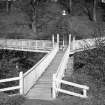
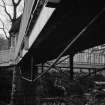
An unusual three-way timber bridge.
J R Hume 2000.
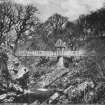
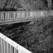
This footbridge carries an estate path over the Kinnel Water within the policies of Raehills House (NY09SE 42.00) and to the W of St Anns village (NY09SE 68).
Information from RCAHMS (RJCM), 22 March 2006.
Publication Account (2007)
An unusual late-19th century creation for the Hope Johnson family of Raehills about 100 yards upstream
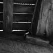
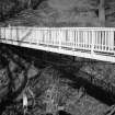
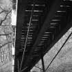
from the A701 road bridge. The bridge formed part of a circular garden walk known as Wallace Loup along each side of the Kinnel Water. Its arms comprise 10 in. deep timber beams 42 ft and 46 ft long, with tension rods beneath, similar to Creel Bridge but deeper, spanning to a pagoda on a central pier of masonry in the river.
The bridge is owned by the Annandale Estates.
R Paxton and J Shipway 2007
Reproduced from 'Civil Engineering heritage: Scotland - Lowlands and Borders' with kind permission from Thomas Telford Publishers.
Field Visit (28 May 2014)
NY 06891 93522 Shelter with conical thatched roof, upon pier in the centre of early/mid 19th century ornamental three ended footbridge over the Kinnel Water, which was previously approached from three directions. There is no evidence of the central thatched shelter and the footbridge has most collapsed. An employee at the Annandale Estate Office in Saint Ann’s stated that the bridge has been in this condition for at least 18 years. The listing description for the structure should be updated accordingly. No photographs are available for this entry.
Visited by Zoe Herbert (SPAB) 28 May 2014, survey no.053


