
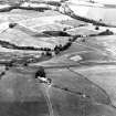
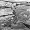
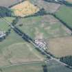
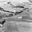
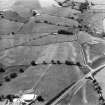
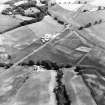
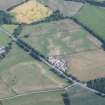
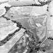
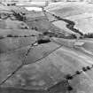
Lag's Tomb


Cropmark(S) (Period Unknown), Enclosure (Period Unassigned)
Site Name Lag's Tomb
Classification Cropmark(S) (Period Unknown), Enclosure (Period Unassigned)
Canmore ID 65938
Site Number NX98SW 51
NGR NX 92578 83209
Datum OSGB36 - NGR
Permalink http://canmore.org.uk/site/65938


- Council Dumfries And Galloway
- Parish Dunscore
- Former Region Dumfries And Galloway
- Former District Nithsdale
- Former County Dumfries-shire
Aerial Photographic Transcription (8 May 2012)

