Pricing Change
New pricing for orders of material from this site will come into place shortly. Charges for supply of digital images, digitisation on demand, prints and licensing will be altered.
Portrack Castle
Castle (Medieval)
Site Name Portrack Castle
Classification Castle (Medieval)
Alternative Name(s) Portract Castle; Porterak
Canmore ID 65899
Site Number NX98SW 16
NGR NX 9389 8316
Datum OSGB36 - NGR
Permalink http://canmore.org.uk/site/65899
- Council Dumfries And Galloway
- Parish Holywood
- Former Region Dumfries And Galloway
- Former District Nithsdale
- Former County Dumfries-shire
NX98SW 16 9389 8316
(NX 9389 8316) Portrack Castle (NR) (Remains of)
OS 6" map (1948)
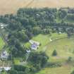
The remains of Portrack or Portract castle consist of a fragment of masonry, 12 feet high, 8 feet 6 inches long and 4 feet thick, which formed the south-west angle of a keep, defended to the north and east by a burn, and to the south and west by an artificial ditch.
'Porterak' and 'Portrack' are mentioned in 1588 and 1602 respectively.
RCAHMS 1920, visited 1912
According to J K S St Joseph, 1949, a small, part-enclosing earthwork to the north, east and south of the castle remains is 'quite distinct' (presumably on APs).
(Undated) information in NMRS.
The fragment of masonry described above has collapsed leaving only a featureless block of rubble masonry up to 1.0m high. The building outline can no longer be discerned. Dense undergrowth may have obscured the earthwork mentioned by St. Joseph which could not be identified. The field to the South of the castle contains many old water channels of the River Nith and no feature there could be certainly identified as an outwork of the castle. The feature shewn on OS 25" as a ditch to the SW of the castle and extending westwards could not be seen.
A ditch 0.4m max, depth and up to 8.0m wide immediately West of the castle site is probably the remains of the artificial ditch mentioned by RCAHM.
Revised at 25".
Visited by OS (RDL) 25 June 1964.


