
Carruchan, Conhuith Plantation


Settlement (Period Unassigned)
Site Name Carruchan, Conhuith Plantation
Classification Settlement (Period Unassigned)
Canmore ID 65695
Site Number NX97SE 24
NGR NX 95868 73785
Datum OSGB36 - NGR
Permalink http://canmore.org.uk/site/65695


- Council Dumfries And Galloway
- Parish Troqueer (Kirkcudbrightshire)
- Former Region Dumfries And Galloway
- Former District Nithsdale
- Former County Kirkcudbrightshire
NX97SE 24 958 738.
See NX97SE 23.
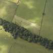
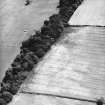
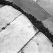
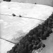
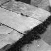
At the edge of Conhuith crag-and-tail, directly above Covenanter's Cave. (Cf NX97SE 23 and NX97SE 32 ).
B Jones 1979; A E Truckell 1984
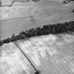
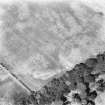
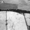
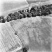
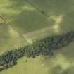
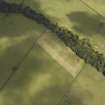
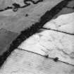
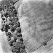
The cropmark of an enclosure, probably a settlement, has been recorded on an un-named knoll at the edge of the terrace overlooking the River Nith 620m NE of Townfoot of Carruchan farmsteading. The ditch is visible on the N, S and W sides whilst the E is a steep slope. Measuring approximately 95m by 50m, with an entrance on the W side, it encloses a palisaded settlement (NX97SE 23) which it appears to intersect briefly at NX c.9584 7380.
Information from RCAHMS (KB) 6 May 1999
Aerial Photographic Transcription (30 May 2012)

