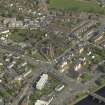
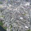
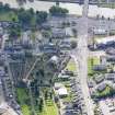
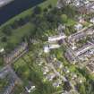
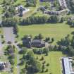
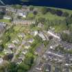
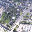
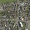
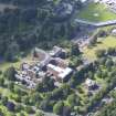
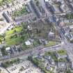
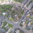
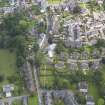
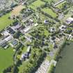
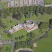
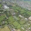
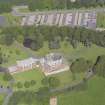
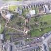
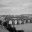
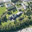
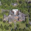
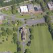
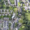
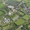
Accessibility

Font Size

100% 150% 200%

Background Colour

Default Contrast
Close Reset

Dumfries, General

Burgh (Medieval), Town (Medieval)

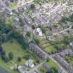
Site Name Dumfries, General

Classification Burgh (Medieval), Town (Medieval)

Canmore ID 65635

Site Number NX97NE 98

NGR NX 97147 76234

NGR Description Centred on NX 97147 76234

Datum OSGB36 - NGR

Permalink http://canmore.org.uk/site/65635

Ordnance Survey licence number AC0000807262. All rights reserved.
Canmore Disclaimer. © Bluesky International Limited 2025. Public Sector Viewing Terms

Toggle Aerial | View on large map

Digital Images

General oblique aerial view of the town, taken from the NW.
General oblique aerial view of the town, taken from the NW.Oblique aerial view centred on the church and graveyard. Taken from the WNW.General oblique aerial view of Crichton Royal Hospital, taken from the NNE.General oblique aerial view of Crichton Royal Hospital, taken from the NW.Oblique aerial view of Crichton Royal Hospital, centred on Crichton Memorial Church, taken from the SSE.Oblique aerial view of Dumfries, centred on Greyfriars Church, taken from the NW.Oblique aerial view.General oblique aerial view of the town, taken from the N.General oblique aerial view of Crichton Royal Hospital, taken from the WSW.General oblique aerial view of Crichton Royal Hospital, taken from the SSW.Oblique aerial view of Crichton Royal Hospital, centred on Crichton Hall, taken from the SSW.Oblique aerial view of Dumfries, centred on St Michael's Church, taken from the NE.Oblique aerial view of Dumfries Burgh Museum and Observatory, taken from the W.Oblique aerial view.Oblique aerial view.Dumfries, General, NX97NE 98, Ordnance Survey index card, RectoFront elevation.Dumfries, town centre, oblique aerial view.General view from south of Dumfries High Street including Midsteeple.Oblique aerial view of Crichton Royal Hospital, centred on Crichton Memorial Church, taken from the NW.Oblique aerial view of Dumfries, centred on Old Bridge, taken from the SE.Oblique aerial view of Dumfries Burgh Museum and Observatory, taken from the SSW.General view of Dumfries showing St Michael's Church and Nithsdale MillOblique aerial view.Oblique aerial view.Oblique aerial view.Oblique aerial view of DumfriesGeneral oblique aerial view of Crichton Royal Hospital, taken from the NNW.Oblique aerial view of Dumfries, centred on St Michael's Church, taken from the NNE.General view of Dumfries showing St Michael's Church in the distanceOblique aerial view.Oblique aerial view centred on the church and graveyard, taken from the NW.Oblique aerial view of Crichton Royal Hospital, centred on Crichton Memorial Church, taken from the WNW.Oblique aerial view of Crichton Royal Hospital, centred on Crichton Hall, taken from the ESE.Oblique aerial view of Dumfries, centred on St Michael's Church, taken from the NNW.Oblique aerial view of Dumfries, centred on St Michael's Church, taken from the WNW.Oblique aerial view of Dumfries Burgh Museum and Observatory, taken from the NW.General oblique aerial view of Crichton Royal Hospital, taken from the E.Oblique aerial view.Oblique aerial view.Oblique aerial view of Crichton Royal Hospital, centred on Rutherford House, taken from the SW.General oblique aerial view of Crichton Royal Hospital, taken from the SSW.Oblique aerial view of Crichton Royal Hospital, centred on Rutherford House, taken from the SW.Oblique aerial view of Dumfries, centred on St Michael's Church, taken from the SE.Oblique aerial view of Dumfries, centred on Old Bridge, taken from the W.General View Troqueer, Kirkcudbrightshire, Scotland. Oblique aerial photograph taken facing North/East. View of bridges in DumfriesGeneral oblique aerial view of the town, taken from the ESE.General oblique aerial view of the town, taken from the NNW.General oblique aerial view of the town, taken from the WNW.General oblique aerial view of the town, taken from the WSW.Oblique aerial view of Crichton Royal Hospital, centred on Rutherford House, taken from the ENE.Oblique aerial view of Crichton Royal Hospital, centred on Crichton Hall, taken from the WSW.Oblique aerial view of Crichton Royal Hospital, centred on Crichton Memorial Church, taken from the WSW.Oblique aerial view of Dumfries Burgh Museum and Observatory, taken from the SE.Distant view of Dumfries town from across the River Nith.Oblique aerial view of DumfriesOblique aerial view of DumfriesGeneral oblique aerial view of Crichton Royal Hospital, taken from the WNW.Oblique aerial view of Dumfries, centred on Old Bridge, taken from the S.Oblique aerial view of Dumfries Burgh Museum and Observatory, taken from the N.Oblique aerial view.Oblique aerial view.Oblique aerial view.

Administrative Areas

  • Council Dumfries And Galloway
  • Parish Dumfries
  • Former Region Dumfries And Galloway
  • Former District Nithsdale
  • Former County Dumfries-shire

Archaeology Notes

NX97NE 98 97147 76234.

See also Maxwellton burgh (NX c. 96 75), NX97NE 115.

Architecture Notes

NX97NE 98 97147 76234 Dumfries, General

At the time of entry it is not possible to determine which Bank of Scotland site relates to drawings DPM 1860/60/1.

See also:

NX97NE 187 9726 7617 52 Queensberry Street, Bank of Scotland

NX97NE 188 9715 7605 103-107 Irish Street, Bank of Scotland Chambers

NX97NE 361 9731 7602 8 English Street, Bank of Scotland

PLANS for V.D. Clinic

Dick Peddie & MacKay, Edinburgh alts

Attic 2, Bin 21, Bag 2 J.M. Dick Peddie 1919

EXTERNAL REFERENCE:

Scottish Record Office

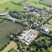
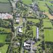
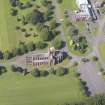
Dumfries, Pavilion or Dining Hall

Erection of a 'Pavilion or Dining Hall'.

The Architect laid plans before the Committee of Dumfries, Kirkcudbright and Wigtown and explained them.

The committee adopted the larger of the two plans and directed the Architect to prepare specifications.

Minutes and Subscription List.

1837 GD 135/Box 61/31

Activities

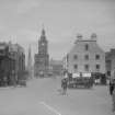
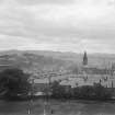
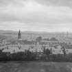
Photographic Survey (1900 - 1930)

Photographs by A Brown & Co of sites across Scotland c1900-1930

References

MyCanmore Image Contributions


Contribute an Image

MyCanmore Text Contributions