
Pricing Change
New pricing for orders of material from this site will come into place shortly. Charges for supply of digital images, digitisation on demand, prints and licensing will be altered.
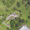
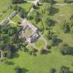
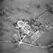
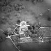
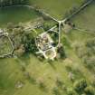
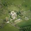
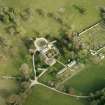
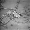
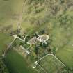
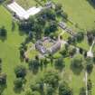
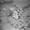
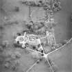
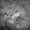
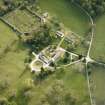
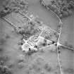
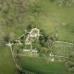
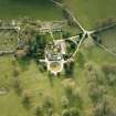
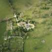
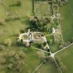
Kirkconnel House, Stables And Outbuildings


Outbuilding(S) (18th Century), Stable(S) (18th Century)
Site Name Kirkconnel House, Stables And Outbuildings
Classification Outbuilding(S) (18th Century), Stable(S) (18th Century)
Canmore ID 65423
Site Number NX96NE 2.01
NGR NX 97911 68010
NGR Description Centred on NX 97911 68010
Datum OSGB36 - NGR
Permalink http://canmore.org.uk/site/65423


- Council Dumfries And Galloway
- Parish Troqueer (Kirkcudbrightshire)
- Former Region Dumfries And Galloway
- Former District Nithsdale
- Former County Kirkcudbrightshire

