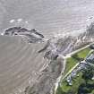
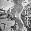
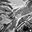
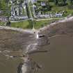
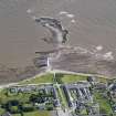
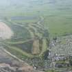
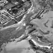
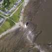
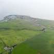
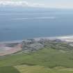
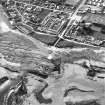
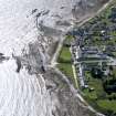
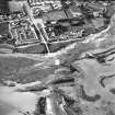
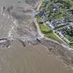
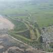
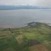
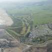
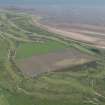
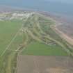
Accessibility

Font Size

100% 150% 200%

Background Colour

Default Contrast
Close Reset

Southerness

Village (Period Unassigned)

Site Name Southerness

Classification Village (Period Unassigned)

Alternative Name(s) Southerness Point; Southernness; Solway Firth

Canmore ID 65408

Site Number NX95SE 2

NGR NX 9759 5437

NGR Description Centred NX 9759 5437

Datum OSGB36 - NGR

Permalink http://canmore.org.uk/site/65408

Ordnance Survey licence number AC0000807262. All rights reserved.
Canmore Disclaimer. © Bluesky International Limited 2025. Public Sector Viewing Terms

Toggle Aerial | View on large map

Digital Images

Oblique aerial view of Southerness Lighthouse, taken from the NNE.
Oblique aerial view of Southerness Lighthouse, taken from the NNE.Oblique aerial view centred on the lighthouse with village adjacent, taken from the NE.Oblique aerial view centred on the lighthouse with village adjacent, taken from the NNE.Oblique aerial view of Southerness Lighthouse, taken from the SE.Oblique aerial view of Southerness Lighthouse, taken from the NW.Oblique aerial view of Southerness Golf Course, looking to the NNW.Oblique aerial view centred on the lighthouse with village adjacent, taken from the S.Oblique aerial view of Southerness Lighthouse, taken from the SSW.General oblique aerial view of Southerness, taken from the NNE.Oblique aerial view.Oblique aerial view centred on the lighthouse with village adjacent, taken from the ESE.Southerness, NX95SE 2, Ordnance Survey index card, RectoOblique aerial view of Southerness Lighthouse, taken from the NE.Oblique aerial view centred on the lighthouse with village adjacent, taken from the SSE.Oblique aerial view of Southerness Lighthouse, taken from the ENE.Solway Firth.  Oblique aerial photograph taken facing north-east.Oblique aerial view of Southerness Golf Course, looking to the NNW.General oblique aerial view of Southerness, looking S.Oblique aerial view of Southerness Golf Course, looking to the NW.Oblique aerial view of Southerness Golf Course, looking to the E.Oblique aerial view of Southerness Golf Course, looking to the E.

Administrative Areas

  • Council Dumfries And Galloway
  • Parish Kirkbean
  • Former Region Dumfries And Galloway
  • Former District Nithsdale
  • Former County Kirkcudbrightshire

Archaeology Notes

NX95SE 2 centred 9759 5437

References

MyCanmore Image Contributions


Contribute an Image

MyCanmore Text Contributions