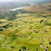
An Dam
Dam (Period Unassigned)
Site Name An Dam
Classification Dam (Period Unassigned)
Canmore ID 6515
Site Number NC80SE 11
NGR NC 8639 0497
Datum OSGB36 - NGR
Permalink http://canmore.org.uk/site/6515
- Council Highland
- Parish Clyne
- Former Region Highland
- Former District Sutherland
- Former County Sutherland
NC80SE 11 8639 0497.
(NC 8639 0497) An Dam (NR)
OS 6"map, (1964)
In the 16th century the Sinclairs made a sudden raid into Clyne. The Sutherlands, taken unawares, retreated up the valley pursued by the Caithness men and took refuge on a small island in Loch Brora. The Caithness men immediately began to form a dam at the mouth of the loch and had nearly drowned the Sutherlands when they (the Sinclairs) were routed and chased away by the Clan Gunn from Kildonan; thus the Sutherlands were saved.
Since then this place at the end of Loch Brora has been called "An Daman" (the small dam).
J Mackay 1894; D MacDonald, A Polson and J Brown 1931.
An irregular line of boulders surveyed at 1:10 560.
Visited by OS (E G C) 7 April 1962.
The name An Dam and the tradition are still known locally. All that remains is an irregular line of spaced boulders completely submerged, across the River Brora.
Visited by OS (J M) 21 August 1975.


