Following the launch of trove.scot in February 2025 we are now planning the retiral of some of our webservices. Canmore will be switched off on 24th June 2025. Information about the closure can be found on the HES website: Retiral of HES web services | Historic Environment Scotland
Mote Of Urr
Motte And Bailey (Medieval)
Site Name Mote Of Urr
Classification Motte And Bailey (Medieval)
Alternative Name(s) Motte Of Urr; Mote Of Galloway; Moat Of Urr
Canmore ID 64982
Site Number NX86SW 1
NGR NX 81526 64684
Datum OSGB36 - NGR
Permalink http://canmore.org.uk/site/64982
First 100 images shown. See the Collections panel (below) for a link to all digital images.
- Council Dumfries And Galloway
- Parish Urr
- Former Region Dumfries And Galloway
- Former District Stewartry
- Former County Kirkcudbrightshire
NX86SW 1 81526 64684
(NX 8152 6467) Mote of Urr (NR)
OS 6" map (1957)
For successor structures, see NX86SW 6 and NX86SW 10.
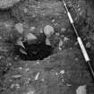
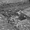
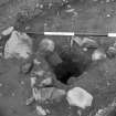
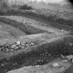
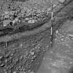
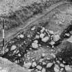
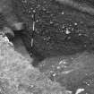
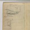
A motte and bailey, excavated by Hope-Taylor in 1951 and 1953.
B Hope-Taylor 1952
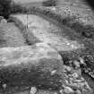
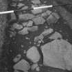
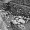
The motte was built between c. 1130-1160, destroyed in 1174 and rebuilt 6' higher than before, having a central tower of timber with a heavy timber palisade, reinforced with rough stone and probably with 'turrets' abutting on its inner surface. A Burgh of Urr existed by 1262, but there seems little trace of occupation after the early 1300's. (B Hope-Taylor, CBA Scottish Group, 8th Report, 10-11)
RCAHMS 1914, visited 1911; B Hope-Taylor 1953; A Truckell and J Williams 1967.
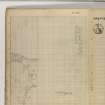
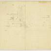
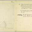
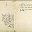
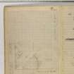
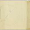
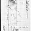
Mote of Urr as described and planned.
Revised at 1/2500.
Visited by OS (WDJ) 15 July 1969.
Publication Account (1986)
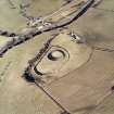
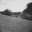
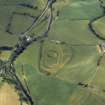
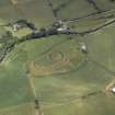
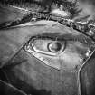
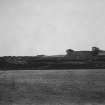
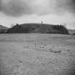
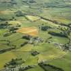
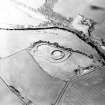
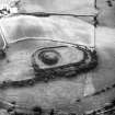
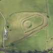
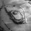
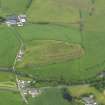
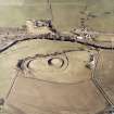
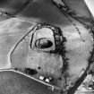
Covering an area of about 2 hectares, this truly impressive earthwork is the most extensive motte-and-bailey castle in Scotland. Only perhaps from the air can one appreciate its great size, looking for all the world like some great earthen battleship stranded on the alluvial river plain. Its position in the valley is not especially commanding; it may originally have been an island, but the river now flows in a single channel to the east. Close up, its deep outer ditch puts one in mind of an iron-age hillfort, and it is possible that the bailey was developed out of an existing fortification in Anglo-Norman times.
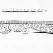
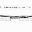
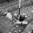
The lower slopes have been artifIcially scarped on the north and east. A 15m-wide ditch surrounds the entire work, and is bridged by causeways in the south-eastern and north-western sectors. Low counter scarp banks can be seen around the lips of this ditch, and the enclosure thus formed is about 150m in maximum length. The motte itself, set within its own ditch,occupies most of the southern end of the enclosure; it rises in the usual 'pudding' or truncated cone form to a sub-circular summit area. Archaeological excavation of part of the motte top showed that the upper 1.83m had been added following the destruction by fire of 12th century timber buildings and palisades; coins and pottery in the upper levels indicated that occupation had continued into the 14th century.
The earliest available records show the lordship of Urr in the possession of Walter de Berkeley (d. c 1194), chamberlain of William I. From him it passed by marriage to a cadet branch of the Balliols, the main line of that family later occupying nearby Buittle Castle. Two witnesses to a Balliol of Urr charter of 1262 were described as burgesses of Urr, but where this burgh settlement was located, whether inside or outside the bailey, and how long it lasted, are not known.
Information from ‘Exploring Scotland’s Heritage: Dumfries and Galloway’, (1986).
Note (July 2017)
A Symbol of Lordship
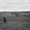
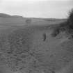
The Mote of Urr is the earthwork remains of a 12th century timber castle known as a motte-and-bailey. It lies 4km north of Dalbeatie in the valley of the Urr Water, and standing on the edge of an old river cliff dominating the haughland of the river it is a very visible feature in the landscape. The river now flows along the east side of the castle, but when it was built it almost certainly flowed along its west side. We know this because the parish boundary follows the course of the Urr Water, preserving its line when the boundary was settled, possibly around the time the castle was built.
The castle comprises a steep-sided, conical, flat-topped mound (the motte) upon which a timber tower may well have stood within a timber palisade, and a lower enclosure (the bailey). The bailey would also have been defended by a timber palisade and housed the service buildings of the castle - stables, workshops, stores and so on. Dumfries and Galloway possesses the greatest concentration of timber castles in Scotland and the Mote of Urr stands out as the most impressive. With the exception of the first castle of Lochmaben at the centre of the Bruce lordship of Annandale, most were built on a more modest scale, often utilising natural features in their construction and not necessarily following the classic motte-and-bailey plan.
There is a long tradition in Scotland of forts and settlements with timber defences, but timber castles as private lordly residences only appeared here in the 12th century. They came with Anglo-Norman lords invited to settle by the 12th and 13th century Kings of Scots seeking to feudalise the kingdom. These lords were usually of Norman, French, Breton or Flemish origin, whose fathers, grandfathers or great grandfathers had settled in England following the Norman Conquest, or who sometimes came directly to Scotland from their homelands.
The probable builder of the Mote of Urr was Walter de Berkley, royal chamberlain to William I ‘the Lion.’ His importance was reflected in the large estate of Urr granted to him by Uhtred, the lord of eastern Galloway, and in the scale of his castle. Although a defensible site and probably built to impress, the Mote of Urr was also the centre from which the accompanying estate was administered, where rents in kind were collected and stored and from which law was dispensed.
Assault, Destruction, Rebuilding?
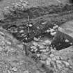
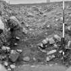
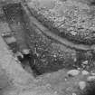
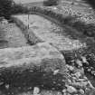
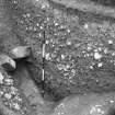
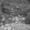
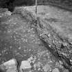
Excavations led by the late Brian Hope-Taylor were carried out on the summit of the motte in 1951 and 1953. He had previously undertaken pioneering work on the motte at Abinger in Surrey, stripping the entire summit and revealing the post-holes of both palisade and central tower. Urr was to be a continuation of this work, but it was discovered that the summit of the motte had been severely disturbed by later medieval activity and no further excavation took place after 1953. However, evidence was recovered suggesting that the structures on the motte had been burned and that rebuilding had subsequently taken place. This has given rise to some speculation that it had been a victim of violent assault, perhaps in the notorious rebellion of 1174 when the chronicler Roger of Howden records that Gilbert and Uhtred ‘the leaders of the men of Galloway… expelled the king’s thanes from their territories, and slew without mercy those of English or French origin whom they found therein. The fortresses and castles which the king of Scots had fortified in their territories they laid siege to, and capturing them, levelled them with the ground.’ An exciting interpretation which may be true, though equally it may be no more than an over enthusiastic conflation of archaeological and documentary evidence.
Peter Corser - Field Officer, Heritage Directorate


