
Leadoch


Enclosure (Period Unassigned)
Site Name Leadoch
Classification Enclosure (Period Unassigned)
Canmore ID 6463
Site Number NC80NE 18
NGR NC 8545 0538
Datum OSGB36 - NGR
Permalink http://canmore.org.uk/site/6463


- Council Highland
- Parish Clyne
- Former Region Highland
- Former District Sutherland
- Former County Sutherland
NC80NE 18 8545 0538.
(NC 8545 0538) Enclosure (NR)
OS 6" map, (1964)
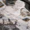
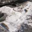
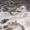
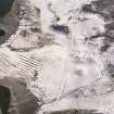
An enclosure situated on top of the SW end of a ridge (OS EGC]) and surveyed at 1:10 560 is possibly a stone-walled hut.
It measures 17.0m N-S by 14.5 between centres of a turf-overgrown wall, and has a likely entrance in the SW arc.
Any traces of contemporary cultivation may have been destroyed by the later depopulated settlement downslope to the SE.
Visited by OS (E G C) 16 July 1961 and (J M) 18 August 1975.

