
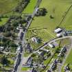
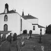
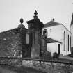
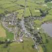
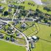
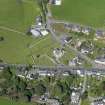
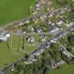
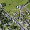
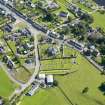
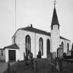
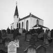
Crossmichael Parish Church, Round Tower And St Michael's Cross


Burial Ground (18th Century), Church (18th Century), Churchyard (18th Century), Tower (16th Century), War Memorial (20th Century)
Site Name Crossmichael Parish Church, Round Tower And St Michael's Cross
Classification Burial Ground (18th Century), Church (18th Century), Churchyard (18th Century), Tower (16th Century), War Memorial (20th Century)
Alternative Name(s) Crossmichael Parish Church And Churchyard
Canmore ID 64618
Site Number NX76NW 8
NGR NX 72977 66985
NGR Description NX 72977 66985
Datum OSGB36 - NGR
Permalink http://canmore.org.uk/site/64618


- Council Dumfries And Galloway
- Parish Crossmichael
- Former Region Dumfries And Galloway
- Former District Stewartry
- Former County Kirkcudbrightshire
NX76NW 8.00 72977 66985
(NX 7297 6698) Church (NAT)
OS 6" map (1958).
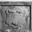
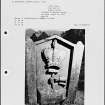
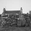
NX76NW 8.01 NX 72994 66978 Gordon Memorial Vault (in burial-ground)
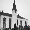
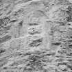
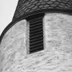
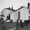
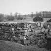
On the south side of the modern church is a round tower with a pointed roof. The church hall is dated 1611, and a burial vault of the Gordons of Aird, in the church yard bears the date 1629.
RCAHMS 1914, visited 1911.
Crossmichael parish church was dedicated to St Michael and belonged to Sweetheart Abbey. Beside the church stood of old St Michael's Cross at which every year was held the Michaelmas Fair of Crossmichael. The fair has lasted on into modern times but the cross has long since gone. The church was rebuilt in 1751.
H Scott 1917.
Crossmichael Church is in normal use, and incorporates a round tower of earlier, PN, work. The barrel-vaulted burial vault, is intact but is now used as a tool-store.
No information was found concerning St Michael's Cross.
Visited by OS (WDJ), 13 August 1968.

