Pricing Change
New pricing for orders of material from this site will come into place shortly. Charges for supply of digital images, digitisation on demand, prints and licensing will be altered.
Carse Mote
Fort (Period Unassigned)
Site Name Carse Mote
Classification Fort (Period Unassigned)
Canmore ID 64047
Site Number NX65SE 11
NGR NX 6955 5336
Datum OSGB36 - NGR
Permalink http://canmore.org.uk/site/64047
- Council Dumfries And Galloway
- Parish Kirkcudbright
- Former Region Dumfries And Galloway
- Former District Stewartry
- Former County Kirkcudbrightshire
NX65SE 11 6955 5336.
(NX 6955 5336) Carse Mote (NR)
OS 6" map (1946)
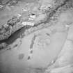
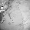
"Carse Moat", Fort: The level summit of this hill has been steeply scarped, 5 to 10 feet high, to form an elliptical area 165 by 140 feet, with evidence of a stony rapart at the NE angle. The entrance was probably on the east side where the scarp is broken by a track. A rampart, 12 feet wide, and 3 1/2 feet high crosses the ridge 21 feet north of the scarped area. No similar rampart can be seen to the south.
RCAHMS 1914, visited 1911; F R Coles 1891
As described by previous authorities. Still known as "Carse Mote".
Resurveyed at 1/2500.
Visited by OS (WDJ) 2 February 1965
Note (20 December 2013 - 23 May 2016)
Situated on a low-lying hillock on the SE side of the River Dee, this earthwork is roughly rectangular plan, and measures about 50m from NE to SW by 42m transversely (0.2ha) within a stony bank largely reduced to a scarp between 1.5m and 3m in height. This evidently descends into an external ditch which is largely obliterated by cultivation, but measures at least 6m in breadth on the NE where an outer bank some 3.5m in thickness by up to 1m in height rides over the spine of the hillock. The entrance may have been on the SE. The interior is featureless.
Information from An Atlas of Hillforts of Great Britain and Ireland – 23 May 2016. Atlas of Hillforts SC0253
Project (1 February 2014 - 24 February 2014)
An archaeological evaluation has been carried out by CFA Archaeology Ltd (CFA) using information provided by the Dumfries and Galloway Historic Environment Record (HER). A desk-based study was undertaken in order to assess the archaeological potential of the proposed development area. No intrusive site investigation work was undertaken during the assessment. A desk-based study was undertaken in order to assess the archaeological potential of the proposed development area. No intrusive site investigation work was undertaken during the assessment. Fifteen cultural heritage features have been identified within the study area. The construction works will involve the extension of the substation. No known cultural heritage features will be directly impacted by the proposed development works.
Information from Hannah Tweedie, CFA Archaeology Ltd., February 2014


