
Following the launch of trove.scot in February 2025 we are now planning the retiral of some of our webservices. Canmore will be switched off on 24th June 2025. Information about the closure can be found on the HES website: Retiral of HES web services | Historic Environment Scotland
Cromsac Hill


Field System (Period Unassigned), Settlement (Period Unassigned)
Site Name Cromsac Hill
Classification Field System (Period Unassigned), Settlement (Period Unassigned)
Canmore ID 6402
Site Number NC76SE 8
NGR NC 7908 6327
Datum OSGB36 - NGR
Permalink http://canmore.org.uk/site/6402


- Council Highland
- Parish Farr
- Former Region Highland
- Former District Sutherland
- Former County Sutherland
NC76SE 8 7908 6327.
At NC 7908 6327, on a natural terrace in a west-facing slope, is a stone walled structure within an associated field system. The structure is heather-covered, and appears to comprise three conjoined, sub-circular or oval chambers within a wall, low and indeterminate in the east, but elsewhere it is up to 0.6m high and spread on average to 2.0m broad.
The inner face of large stones on edge retaining a rubble core is exposed here and there. A lowering in the wall in SW arc may represent an entrance.
The field system around the structure occupies one hectare some irregurly-shaped cultivation plots can be identified (one measures 25.0m by 15.0m) bounded by clearance both linear and in heaps, and one or two lynchets. Down the slope some 80.0m to the west is further evidence of cultivation indicated by scattered clearance heaps. The pattern of cultivation is of the type commonly found in association with hut circles, and the mode of construction of the feature is distinctly 'hut-like'.
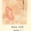
Surveyed at 1:10,000.
Visited by OS (N K B) 1 July 1977.

