
West Burra, Minn 2, House


House (Period Unassigned)
Site Name West Burra, Minn 2, House
Classification House (Period Unassigned)
Alternative Name(s) Minn Ii
Canmore ID 639
Site Number HU33SE 45
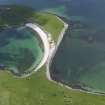
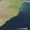
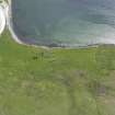
NGR HU 3606 3022
Datum OSGB36 - NGR
Permalink http://canmore.org.uk/site/639


- Council Shetland Islands
- Parish Lerwick
- Former Region Shetland Islands Area
- Former District Shetland
- Former County Shetland
HU33SE 45 3606 3022
See also HU33SE 43
Situated c 90m to the north west of HU33SE 44 on higher gently sloping ground to the north of the stream. The structure is very badly preserved there being few remaining stones and only a shallow banking c.0.1 to 0.15m high indicating the line of the wall. It would appear to have had a main part measuring c.7 by 7.5m with an annexe to the east, measuring c.3.5 by 4m, giving an overall length of c.11m and an east-west orientation.
J W Hedges 1984

