Pricing Change
New pricing for orders of material from this site will come into place shortly. Charges for supply of digital images, digitisation on demand, prints and licensing will be altered.
Barholm Castle
Tower House (Medieval)
Site Name Barholm Castle
Classification Tower House (Medieval)
Canmore ID 63738
Site Number NX55SW 4
NGR NX 52073 52959
Datum OSGB36 - NGR
Permalink http://canmore.org.uk/site/63738
First 100 images shown. See the Collections panel (below) for a link to all digital images.
- Council Dumfries And Galloway
- Parish Kirkmabreck
- Former Region Dumfries And Galloway
- Former District Wigtown
- Former County Kirkcudbrightshire
NX55SW 4 52073 52959
(NX 5207 5296) Barholm Castle (NR) (Remains of)
OS 6" map (1957)
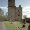
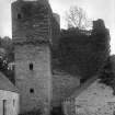
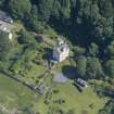
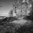
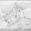
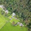
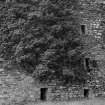
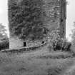
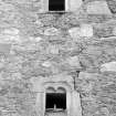
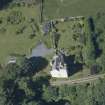
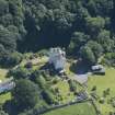
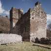
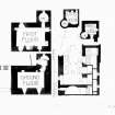
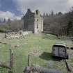
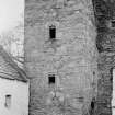
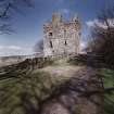
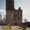
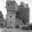
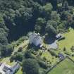
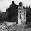
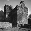
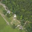
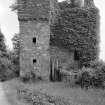
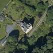
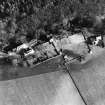
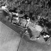
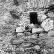
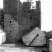
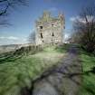
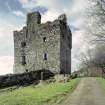
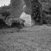
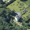
Barholm Castle, now ruinous, is L-shaped on plan, comprising an oblong parapeted tower to which has been attached a small, but higher wing containing the stair, the upper portion of which acts as a caphouse reached by a little turret-stair projecting in the re-entrant angle. The main block stands three storeys and a garret high. Abutting the W wall of the castle is an enclosure formed by ruined walls c. 9' high by 3' thick, it seems to have been used as a cottage and is probably contemporary with the adjacent farm-house dated 1797.
Barholm has belonged to the M'Cullochs from the beginning of the 16th century, but, judging by the details, the existing building would date from the early 17th century.
RCAHMS 1914, visited 1911; N Tranter 1965.
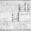
As described and planned.
Visited by OS (RD) 13 March 1972.
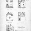
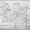
NX 5207 5296 Archaeological survey and analysis was completed at Barholm Castle in July 2000. The L-plan tower house is thought to date from the early 16th century, although the tower component may be earlier. Exterior elevations were made of the tower, alongside the compilation of a catalogue of archaeological features. The elevations were prepared by a combination of rectified photography and total station measurement. Additional excavation and research over the coming year will shed further light on the history and development of the monument, which is privately owned.
A Dunn 2000
NX 5207 5295 As part of the restoration and consolidation of the 16th-century tower of Barholm Castle (see DES 2000, 21), a watching brief was maintained between July and September 2003 in the immediate vicinity of the tower during installation of a septic tank, soakaway and scaffolding supports. In addition, there is an ongoing programme of recording of interior elevations and wall heads.
Archive to be deposited in the NMRS.
G Ewart 2003
NX 520 529 As the culmination of a full structural survey on the 15th-century tower house (NX55SW 4) completed in advance of any rebuilding and down-taking (DES 2000, 21), a programme of archaeological excavation was undertaken between May and September 2004 on the ground and first floors of the tower. In addition, the stair interior and all internal elevations were recorded.
The results showed how the earliest version of the tower (late 15th century) had been converted at its upper levels by the addition of new fireplaces, chimneys and a raised wall head during the 16th century. The latter saw the construction of a new caphouse over the extended stair tower and parapet wall walk.
Archive to be deposited in the NMRS.
Sponsor: HS.
S Coulter and P Fox 2004
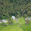
NX 520 529 A watching brief was undertaken in May 2005 during excavations for the installation of services for the recently restored tower house (NX55SW 4; DES 2004, 36). Trenches were located to the S and E of the tower. Nothing of archaeological interest was recovered in these shallow cuts.
Archive to be deposited in NMRS.
Sponsor HS
S Coulter and G Ewart 2005.
Descheduled.
Information from Historic Scotland: certificate of exclusion from schedule dated 5 November 2008.
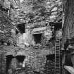
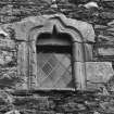
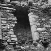
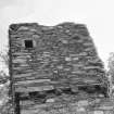
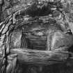
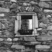
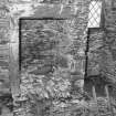
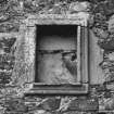
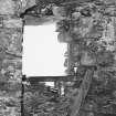
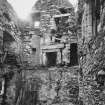
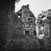
Photographic Survey (June 1964)
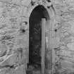
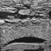
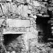
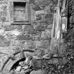
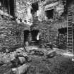
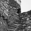
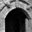
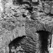
Photographic survey of Barholm Castle, Kirkcudbrightshire, by the Scottish National Buildings Record in 1964.
Standing Building Recording (26 October 1999)
In October 1999 Kirkdale Archaeology undertook a one day survey of Barholm Castle in preparation for a longer period of survey work in July 2000. Information from this survey can be found in the Kirkdale Archive.
G Ewart 1999
Sponsor: Private Owner
Kirkdale Archaeology
Archaeological Evaluation (July 2000)
NX 5207 5296 Archaeological survey and analysis was completed at Barholm Castle in July 2000. The L-plan tower house is thought to date from the early 16th century, although the tower component may be earlier. Exterior elevations were made of the tower, alongside the compilation of a catalogue of archaeological features. The elevations were prepared by a combination of rectified photography and total station measurement. Additional excavation and research over the coming year will shed further light on the history and development of the monument, which is privately owned.
A Dunn 2000
Excavation (June 2003 - September 2004)
NX 5207 5295
As part of the restoration and consolidation of the 16th-century tower of Barholm Castle (see DES 2000, 21), a watching brief was maintained between July and September 2003 in the immediate vicinity of the tower during installation of a septic tank, soakaway and scaffolding supports. In addition, there is an ongoing programme of recording of interior elevations and wall heads.
As the culmination of a full structural survey on the 15th-century tower house (NX55SW 4) completed in advance of any rebuilding and down-taking (DES 2000, 21), a programme of archaeological excavation was undertaken between May and September 2004 on the ground and first floors of the tower. In addition, the stair interior and all internal elevations were recorded.
The results showed how the earliest version of the tower (late 15th century) had been converted at its upper levels by the addition of new fireplaces, chimneys and a raised wall head during the 16th century. The latter saw the construction of a new caphouse over the extended stair tower and parapet wall walk.
G Ewart, S Coulter and P Fox 2004
Sponsor: Historic Scotland
Kirkdale Archaeology
Excavation (21 January 2004 - 25 June 2004)
As the culmination of a full structural survey on the 15th-century tower house (NX55SW 4) completed in advance of any rebuilding and down-taking (DES 2000, 21), a programme of archaeological excavation was undertaken between May and September 2004 on the ground and first floors of the tower. In addition, the stair interior and all internal elevations were recorded.
The results showed how the earliest version of the tower (late15th century) had been converted at its upper levels by the addition of new fireplaces, chimneys and a raised wall head during the 16th century. The latter saw the construction of a new caphouse over the extended stair tower and parapet wall walk.
S Hogg and P Fox
Excavation (4 May 2005 - 5 May 2005)
NX 520 529 A watching brief was undertaken in May 2005 during excavations for the installation of services for the recently restored tower house (NX55SW 4; DES 2004, 36). Trenches were located to the S and E of the tower. Nothing of archaeological interest was recovered in these shallow cuts.
S Coulter and G Ewart 2005
Sponsor: Historic Scotland
Kirkdale Archaeology


