Cairnholy 4
Cup And Ring Marked Rock (Neolithic) - (Bronze Age)
Site Name Cairnholy 4
Classification Cup And Ring Marked Rock (Neolithic) - (Bronze Age)
Alternative Name(s) Cairnholy 4; Cairn Holy; Kirkdale
Canmore ID 63726
Site Number NX55SW 29
NGR NX 51551 54637
Datum OSGB36 - NGR
Permalink http://canmore.org.uk/site/63726
- Council Dumfries And Galloway
- Parish Kirkmabreck
- Former Region Dumfries And Galloway
- Former District Wigtown
- Former County Kirkcudbrightshire
NX55SW 29 5155 5463.
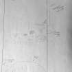
NX 515 546. Cup-and-Ring marks are carved on a rock outcrop forming a hillock 350yds ENE of Kirkmuir farm, beside the W wall of a field. The marks comprise 3 cups with one, two, and three rings respectively, very worn in parts and nine cups.
RCAHMS 1914, visited 1912; R W B Morris and D C Bailey 1967
The cup-and-ring marks described were located at NX 5157 5458.
Visited by OS (RD) 29 February 1972
NX 5155 5463 These cup marks occupy a 5.0m long face of outcropping rock and are generally as described in the previous information. The "cup with three rings" measures 0.3m in overall diameter, the cup itself being 7 cms in diameter and 3 cms deep. On the same outcrop are a large number of single 'cups' many of which are natural.
Surveyed at 1:2500.
Visited by OS (BS) 22 June 1977
Van Hoek divides the marks on this outcrop into seven groups, labelling them Cairnholy 4A-4G. Two of these groups were reported in 1992 ('Cairnholy 4F' by Van Hoek and 'Cairnholy 4E' by Schilders) at NX 5157 5458, some 50m to the SE, and these were formerly noted under NX55SW 59 and NX55SW 63. Van Hoek's 1995 description, however, makes it clear that these marks are on the same outcrop as the other 'Cairnholy 4' groups. In all about one hundred cups have been identified, eleven of them having between one and three rings. Naddair deturfed more of the outcrop, and identified over 200 cups.
M A M van Hoek 1992, L Schilders 1992, M A M van Hoek 1995, K Naddair 1995.
Field Visit (28 April 1994)
These markings are exposed in an area measuring about 5m NNW-SSE by 3.5m transversely on top of a prominent outcrop about 350m ENE of Kenmuir farmsteading. At least 31 plain cups, in four clusters, were identified, along with a cup-and-one-ring, 140mm in diameter, and two cup-and-two-rings, 190mm and 210mm in diameter, the last of these having a possible third ring 340mm across and a cup 70mm in diameter and 25mm deep.
(Cree94 303)
Visited by RCAHMS (SDB) 28 April 1994
Note (13 April 2019)
Date Fieldwork Started: 13/04/2019
Compiled by: Whithorn
Location Notes: This is one of a group of carvings recorded at this location (see also Cairnholy 11, 12, 13 and 14). These carvings are located across the surface on an exposed outcrop which lies adjacent to the field wall at the lower, W edge of a field of improved pasture. The carving are positioned primarily towards the eastern most edge of the outcrop, which has a steep drop off to the north, west and south. The grid reference recorded at the time of survey (NX 51551 54637) was taken with 1.5m accuracy. There are other rock art panels nearby: Cairnholy 12 is 1.8m to the SW, Cairnholy 13 is 2m to the S of Cairnholy 4. In the wider landscape, Cairnholy 8 (ScRAP ID: 1090; Canmore ID: 77510) is located c. 100m to the NE, and Cairnholy 5 (ScRAP ID: 2159; Canmore ID: 63728)is located c. 180m to the NNE.
This record has here been allocated solely to the record of Cairnholy 4 (Van Hoek's Cairnholy 4B), the other panels previously recorded under this record have been allocated their own unique records.
Panel Notes: This panel is located on the highest point of the extreme N edge of the outcrop, on a roughly rectangular shaped projection measuring 1.5m by 1.1 m and up to 0.4m in height. The upper surface has been carved with one relatively deep cup mark (measuring 80mm in diameter and 20mm deep) enclosed by 2 rings (one complete; the other partial on the E side), and 1 possible cup to the west. There is one more probable cup on the W edge of the rock.


