Pricing Change
New pricing for orders of material from this site will come into place shortly. Charges for supply of digital images, digitisation on demand, prints and licensing will be altered.
Cauldside Burn
Burial Cairn (Bronze Age), Cist (Bronze Age)
Site Name Cauldside Burn
Classification Burial Cairn (Bronze Age), Cist (Bronze Age)
Canmore ID 63680
Site Number NX55NW 22
NGR NX 52935 57147
Datum OSGB36 - NGR
Permalink http://canmore.org.uk/site/63680
- Council Dumfries And Galloway
- Parish Anwoth
- Former Region Dumfries And Galloway
- Former District Stewartry
- Former County Kirkcudbrightshire
NX55NW 22 5294 5714
(NX 5293 5714) Cairn (NR)
OS 6" map (1957)
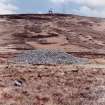
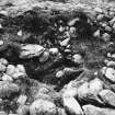
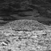
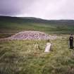
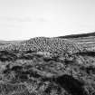
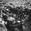
This cairn measures 63' in diameter and 10' in height. A short cist, formed of four slabs, measuring 3' in length and breadth by 2' 8" deep is exposed. Its lowest level is 5' 6" from the present summit of the cairn, thus indicating its secondary character.
RCAHMS 1914, visited 1912; I F MacLeod 1969
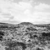
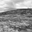
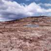
NX 5293 5715. A well-preserved cairn situated on the bottom of the saddle between Cairnharrow and Cambret Hills at 735ft OD. It is 21.0m diameter and 2.5m high with a central hollow (2.5m diam and 1.2m deep) in the bottom of which lies the exposed cist complete with collapsed capstone. There is the suggestion of a 1.5m wide "berm" on the east side of the cairn but this is almost certainly the result of robbing. There is no kerbing evident as shown on the RCAHMS plan.
Surveyed at 1:10 000.
Visited by OS (TRG) 20 June 1966
Field Visit (5 June 1994)
This cairn, which lies to the S of the Cauldside Burn in the saddle between Cambret Hill and Cairnharrow, measures 18m in diameter by up to 3.5m in height. At the centre of the mound there is a hollow, about 1m in depth, within which there is a cist; it measures 1m from E to W by 0.6m transversely, and its base must lie about 2.5m above ground level. The broken capstone lies within the cist. Stone appears to have been robbed from the perimeter of the cairn, leaving a berm-like terrace, about 2m broad, marking the original extent of the mound. On the W of the cairn there is a slight ditch, which may be natural.
(Cree94 355)
Visited by RCAHMS (DCC) 5 July 1994


