Pricing Change
New pricing for orders of material from this site will come into place shortly. Charges for supply of digital images, digitisation on demand, prints and licensing will be altered.
Upcoming Maintenance
Please be advised that this website will undergo scheduled maintenance on the following dates:
Thursday, 9 January: 11:00 AM - 3:00 PM
Thursday, 23 January: 11:00 AM - 3:00 PM
Thursday, 30 January: 11:00 AM - 3:00 PM
During these times, some functionality such as image purchasing may be temporarily unavailable. We apologise for any inconvenience this may cause.
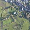
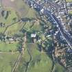
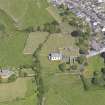
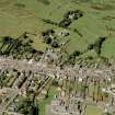
Whithorn, General
Burgh (Medieval), Village (Period Unassigned)
Site Name Whithorn, General
Classification Burgh (Medieval), Village (Period Unassigned)
Canmore ID 63272
Site Number NX44SW 20
NGR NX 44568 40211
NGR Description Centred on NX 44568 40211
Datum OSGB36 - NGR
Permalink http://canmore.org.uk/site/63272
- Council Dumfries And Galloway
- Parish Whithorn
- Former Region Dumfries And Galloway
- Former District Wigtown
- Former County Wigtownshire
NX44SW 20 centred 44568 40211
Not to be confused with Isle of Whithorn village, see NX43NE 32 477 365.
Whithorn was created an ecclesiastical burgh in a charter to the prior and convent of Candida Casa by Robert I dated 20 May, 1325. This was confirmed in charters of James II dated 1 July, 1451 and 14 July 1459. It was erected to royal burgh status by James IV, 1 May 1511.
G S Pryde 1951; Reg Magni Sig Reg Scot
Whithorn. Small town whose site was a centre of population by the early 5th century, when St Ninian established it as the seat of a bishopric. Evidence of the early history, discovered by excavation since 1986, shows successive developments from the 8th to the 11th centuries, their character apparently changing from British to Anglian to Irish. The church (NX44SW 5), housing the relics of St Ninian and a place of pilgrimage, was rebuilt as a cathedral and priory church in the 12th century, the date of the earliest parts of the present ruin.
A burgh was erected under the feudal superiority of the priory in 1325 and Whithorn became a royal burgh in 1511, but it was never of more than minor local significance. There is one main street, its middle stretch appearing very broad since 1814, when the Town House which had projected inti it was replaces. The houses were mainly rebuilt from the early 19th century.
J Gifford 1996.
NX 445 402 A watching brief was maintained during the excavation of service trenches in Whithorn in April 2007. The
town itself is of great archaeological and historical significance as the site of the earliest Christian monastery in Scotland and a thriving medieval burgh, and was an important focus of pilgrimage both historically and into the present day. The trenches had the potential to affect significant archaeological deposits. Part of the work was undertaken in accordance with scheduled monument consent. The trenching was divided into four areas; Areas 1-3 had high potential and were monitored by Headland, while Area 4 had low potential and groundworks were monitored by the Whithorn Trust.
Areas 1 and 2 were at the medieval centre of the town, next to the early Christian site and the old pilgrim road; Area 3 was next to the former entrance or 'port' site at the S end of the medieval town. The trenches in Area 1 revealed a single, possible waterlogged deposit, heavily truncated by modern service trenches. This probably represented periodic waterlogging in a poorly drained area. The extreme eastern end of the trench encroached into the scheduled area, but no features or deposits with archaeological potential were encountered. Area 2 contained the partial remains of a mortared and cobbled road surface of probable post-medieval date immediately below the modern road surface. The Area 3 trenches were completely devoid of any potential archaeological features and the modern road surface
immediately overlay the natural bedrock. No further features or deposits of archaeological significance were identified during the course of the watching brief.
Report and archive to be deposited with RCAHMS. Report deposited with Dumfries and Galloway SMR.
Funder: Scottish Power Systems Ltd.
Kate Bain, 2007.
EXTERNAL REFERENCE
Scottish Records Office
Survey report of Royal Burgh.
Description of : The Priory
Old Town Hall
New Town Hall (erected 1885)
Churches
Cinemas
Schools
Buildings for Industry, Commerce and Housing.
20th c. GD 138/2/171
EXTERNAL REFERENCE
Scottish Records Office
Ersick. Plan and specification of Ersick House.
Letter from John Fraser to George Guthrie.
He has sent a plan and specification of Ersick House and asks if it is intended to accept his plan for Castle Steward.
1843 GD 135/Box 61/30/3
Letter and sketch plan of how the Dwelling and Office houses at Ersick were 'laid off by Messrs Porteous and Fraser'.
Letter from John McConnell to George Guthries. He asks if the masons are to being on the site already marked off or at the head of the yard and are the iffice houses to be rebuilt in the present position.
1842 GD 135/Box 62/31/7
Watching Brief (April 2007)
NX 445 402 A watching brief was maintained during the excavation of service trenches in Whithorn in April 2007. The town itself is of great archaeological and historical significance as the site of the earliest Christian monastery in Scotland and a thriving medieval burgh, and was an important focus of pilgrimage both historically and into the present day. The trenches had the potential to affect significant archaeological deposits. Part of the work was undertaken in accordance with scheduled monument consent. The trenching was divided into four areas; Areas 1-3 had high potential and were monitored by Headland, while Area 4 had low potential and groundworks were monitored by the Whithorn Trust.
Areas 1 and 2 were at the medieval centre of the town, next to the early Christian site and the old pilgrim road; Area 3 was next to the former entrance or 'port' site at the S end of the medieval town. The trenches in Area 1 revealed a single, possible waterlogged deposit, heavily truncated by modern service trenches. This probably represented periodic waterlogging in a poorly drained area. The extreme eastern end of the trench encroached into the scheduled area, but no features or deposits with archaeological potential were encountered. Area 2 contained the partial remains of a mortared and cobbled road surface of probable post-medieval date immediately below the modern road surface. The Area 3 trenches were completely devoid of any potential archaeological features and the modern road surface immediately overlay the natural bedrock. No further features or deposits of archaeological significance were identified during the course of the watching brief.
Report and archive to be deposited with RCAHMS. Report deposited with Dumfries and Galloway SMR.
Funder: Scottish Power Systems Ltd.
Test Pit Survey (1 September 2011 - 30 March 2012)
NX 445 402 (centred on) The Machars Archaeology Project was a community survey, which aimed to create a record of archaeological sites and monuments in the Machars. The survey work was undertaken 1 September 2011 – 30 March 2012 by volunteers and professional archaeologists in several areas in Wigtownshire and included updates and verifications of the existing RCAHMS records for a wide range of site types. In addition to the production of a site gazetteer, detailed surveys were carried out at several sites, with volunteers receiving training in manual plane table survey as well as digital techniques such as differential GPS, total station survey and laser scanning. In addition, a graveyard survey was carried out at Kirkmaiden Old Church.
A large number of training workshops and outreach activities accompanied the survey, including activities for local school children and seminars on recording techniques and medieval and post-medieval ceramics. One of the key events was the 'Whithorn Big Dig'. Residents in Whithorn were invited to dig test pits in their back gardens under archaeological supervision. The finds from these test pits were identified by specialists at the Whithorn Story visitor centre, and included ceramics from every century from the medieval period to the modern day. The project results may be found at www.aocarchaeology.com/machars
Archive: RCAHMS
Funder: Heritage Lottery Fund, Dumfries and Galloway Leader
Graeme Cavers, AOC Archaeology Group
Charlotte Douglas,
Gemma Hudson,
Diana Sproat,
2012


