
Drumtroddan 1


Cup And Ring Marked Rock (Neolithic) - (Bronze Age)
Site Name Drumtroddan 1
Classification Cup And Ring Marked Rock (Neolithic) - (Bronze Age)
Canmore ID 62794
Site Number NX34SE 49
NGR NX 36287 44717
Datum OSGB36 - NGR
Permalink http://canmore.org.uk/site/62794


- Council Dumfries And Galloway
- Parish Mochrum
- Former Region Dumfries And Galloway
- Former District Wigtown
- Former County Wigtownshire
NX34SE 49 3628 4471.
Situated some 200m S of Drumtroddan farm, inside the SE of two small fenced enclosures are several boulder-like greywacke outcrops, the biggest being 1.25m by 0.75m by 0.25m high. On them respectively are: (a) On the biggest outcrop: a cup-and-five-complete-rings, with a radial groove downwards from cup to ground.
(b) 3m to its S: a cup-and-five-rings with two faint parallel grooves, both probably from the cup, and also a cup-and-four-complete-rings with a natural bisecting groove.
(c) 4m SW of 'a': a cup-and-six-complete-rings with a natural bisecting groove. This, 35cm in diameter, is the biggest carving in the group.
(d) 6.5m SW of 'a' is a group of four very faint cups-and-rings, two with five rings, one with three rings, and one with two rings.
R W Feachem 1963; R W B Morris and D C Bailey 1967; R W B Morris 1967; 1979
Surveyed at 1:2500 scale.
Visit by OS January 1973.
Note (29 April 2019)
Date Fieldwork Started: 29/04/2019
Compiled by: ScRAP Team
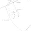
Location Notes: Drumtroddan 1 is part of a group of cup-and-ring marked rocks (Drumtroddan 1 - 4) located within a fenced-off area in a field approximately 200m S of Drumtroddan Farm. Further rock art panels are located within a similarly fenced-off enclosure approximately 20m to the NW (Drumtroddan 8-13), and within a wooded area approximately 70m to the W (Drumtroddan 5-7). Drumtroddan 1 - 4 are part of the same Canmore ID (62794) and HER record (MDG2466) and, together with the panels in the other fenced-off enclosure and within the wooded area, are included within the same scheduled monument designation (SM90101), and are properties in care. Drumtroddan standing stones (Canmore ID: 62762) are approximately 400m to the S.
The two enclosures lie on the highest point of the field, and are part of a large area of outcropping rock. There are views in all directions, and particularly to the N, E and W. The enclosure within which Drumtroddan 1 is located, measures approximately 10m x 10m. Drumtroddan 1 is the most northerly of the panels within the enclosure, with Drumtroddan 2 lying approximately 3m to the S, Drumtroddan 3 approximately 4m to the SW and Drumtroddan 4 approximately 7m to the W.
Panel Notes: Drumtroddan 1 is a small exposed area of a larger greywacke outcrop. The panel has a flat surface which sloped to the WNW, running into the turf on its W side. On its E side, there is a small vertical drop to grass-level. The panel shows extensive lichen cover.
The panel, which measures 1.2m x 0.7m in size and is up to 0.2m in height, has been decorated with one large motif of a cup-and-five rings, measuring approximately 45cm across. A radial runs from the central cup across the motif to the ground. It appears to be a natural fissure which has been enhanced. All parts of the motif are clear, although the outermost ring shows slightly more evidence of erosion. It is also crossed and broken by a natural fissure which curves across the panel surface.

